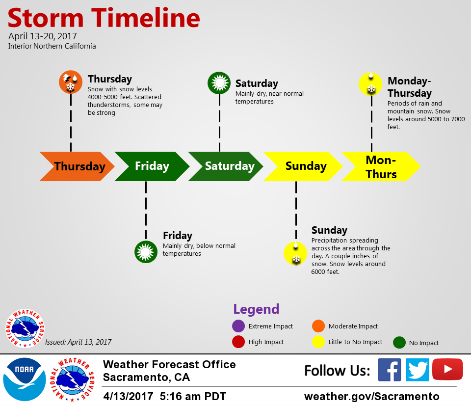
April 13, 2017 – Pacific storm moves through today with some breezy wind, valley rain and mountain snow. Threat of thunderstorms today with possible small hail. Drier weather Friday and Saturday, then additional storms expected Sunday into next week.
Discussion
An upper level trough with a surface cold front is pushing through the area. Caltrans has reported 4 inches of snow between 9 am and 2 am at their Kingvale station at 6100 feet. Webcams show I80 snow covered from there up to Donner Pass.
Blue Canyon at 3 am had rain and was 35 F, so the snow level is likely around 5500 feet. A Winter Weather Advisory remains in effect until 8 pm this evening.
There may be a brief mid morning lull in snow intensity between the departing cold front and convective showers developing late in the morning and continuing through the afternoon into the early evening. These showers could be locally heavy, and if over highways could cause further travel problems with brief bursts of heavy snow. These could also locally lower snow levels below 4000 feet and possibly below 3500 feet.

Convective development behind the cold front could bring heavier showers and thunderstorms starting as early as mid morning. The latest HRRR model run indicates these could start around the Sacramento to Marysville to Chico area by late morning, then across the Valley this afternoon. There could be a convergence area setting up around Redding, as well. Shear profiles more favorable in Northern and Central Sac Valley to support possible rotating storms, which could bring severe weather.
Breezy southerly winds could gust to 20-25 mph this afternoon.
Drier weather returns Friday and Saturday as upper level ridging moves over NorCal.
Another upper low with a cold front spreads in Sunday from west to east. Precipitation amounts will generally be light, especially in the morning. A couple inches of snow are possible above 6000 feet late Sunday into early Monday.
Extended discussion (Monday through Thursday)
Northern California will remain under moist southwesterly flow on Monday, and likely continue to do so through at least the middle of next week. As such, periods of precipitation will be likely across most of the region, though the timing of individual shortwave troughs will likely remain uncertain for some time. As such, we’ve broad brushed the forecast with higher than climo chances of precipitation.
Longer range models do hint at drier weather toward the end of next week.