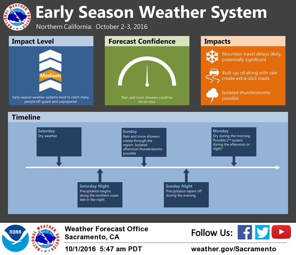
October 1, 2016 – A weather system will bring unseasonably cool temperatures, Valley rain, mountain snow, and possible thunderstorms Sunday into early Tuesday. Drier weather expected by the middle of next week. Winter Weather Advisory from 11 AM Sunday to 5 AM PDT Monday for West Slope Northern Sierra Nevada-Western Plumas County/Lassen Park.
Discussion
Clear skies prevail across interior Northern California, behind a dry upper level front that passed through yesterday. Looking upstream, an unseasonably deep upper low is centered off the Vancouver Island coast and rapidly dropping southward. We’ve already seen a fair bit of synoptic cooling associated with this system, and temperatures across the region are running up to 10 degrees cooler than yesterday.
Dry weather will continue today, with high temperatures reaching the 70s across the Valley, and 50s and 60s over the mountains. These forecast highs are 5 to 10 degrees cooler than normal.
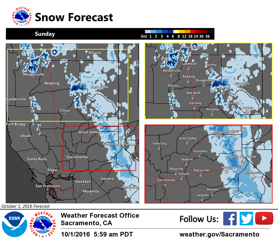
The aforementioned upper low will quickly move toward the region, moving inland near the CA/OR border Sunday. This isn’t the most favorable track for a widespread rain for NorCal. But this system brings quite the cool airmass and instability, and should be efficient in wringing out precipitation. Isolated thunderstorms are possible Sunday afternoon and evening. Snow levels are expected to rapidly drop to around or below 6000 ft by Sunday afternoon, with a few inches of snow possible at pass level. Given the long stretch of dry weather we’ve experienced, and traditionally heavy weekend traffic over the mountains, major travel headaches will be possible with even minor snow accumulations.
Computer models have been trending wetter with a northwesterly wave moving through NorCal Monday afternoon and night. Confidence isn’t strong with this secondary system, but we did bump up our precipitation forecast rather substantially to match model trends.
Extended discussion (Wednesday through Saturday)
Middle portion of the week looks dry under relatively flat upper level high pressure ridge. Daytime temperatures warm each day but still remain a few degrees below normal. GFS shows a moderate northerly surface gradient from MFR to SAC of about 9mb so expect breezy north winds on Wednesday although upper level support is not ideal. Surface gradient weakens on Thursday as the upper ridge axis shifts eastward into the Great Basin. A weak upper trough moves through the Pacific Northwest on Friday bringing a threat of showers to the northern most state. Most areas should see a slight cooling. Temperatures warm again slightly on Saturday under weak high pressure.