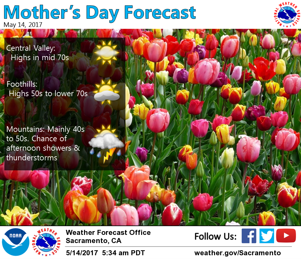
May 14, 2017 – Low pressure will maintain below normal daytime temperatures and a chance of mountain showers through Monday. Colder and wetter storm moves through Tuesday into Wednesday bringing a chance for showers and light mountain snow. Dry and warmer Thursday into next weekend.
Discussion
Water vapor imagery showing upper low has developed off the NW CA coast per models and is progged to move inland over Interior NorCal today. This will result in increased synoptic scale UVM over the forecast area. Combined with differential heating over the mountains and moisture flux convergence, a potential exists for afternoon showers and thunderstorms over the higher terrain today. Snow levels forecast around 6500 feet today with the potential for some light snow accumulation over higher terrain. High temperatures today will be in the mid 70s in the Central Valley with 40s to 60s for the mountains and foothills.
Models differ with how quickly to progress the low out of our CWA so will keep a mention of possible showers over the mountains of Western Plumas and Sierra Nevada Monday. High temperatures expected to be near to slightly warmer tomorrow.
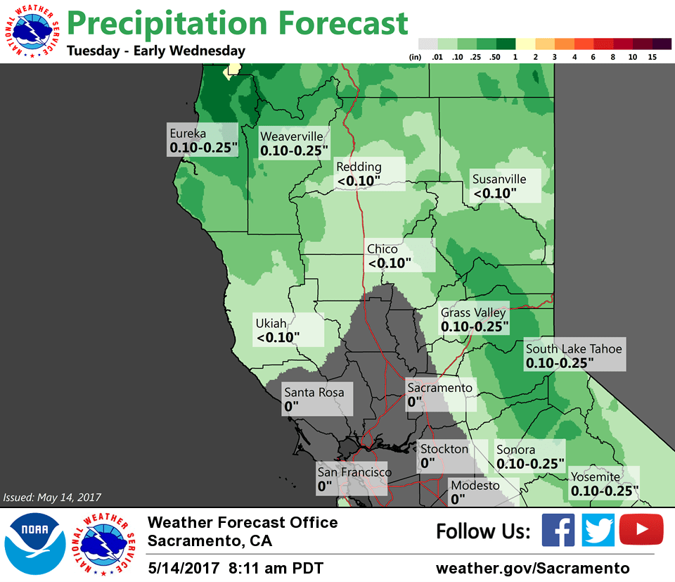
Next upper low progged to dig across the PacNW into the Great Basin Tuesday into early Wednesday. Models continue a more eastward track with system clipping mainly northern and northeast portions of our CWA. QPF has also trended less. Best chances for any measurable precip in the Central Valley looks to be over the northern and eastern portions of the Sacramento Valley. Instability looks less and have removed mention of thunderstorms Tuesday. Snow levels in the mountains will be around 5500 to 6500 during peak potential precip period however only a few inches of accumulations are expected at pass levels. Cooler with breezy conditions forecast Tuesday with high temperatures about 10 degrees lower than Monday.
Decreasing POPs over the Sierra Nevada Tuesday night into Wednesday, otherwise mainly dry for Interior NorCal midweek with warming temperatures.
Extended discussion (Thursday through Sunday)
A return to dry and warmer weather is expected across interior NorCal later this week as ridging from the eastern Pacific builds onto the West Coast. Breezy north winds will be possible through the Central Valley Thursday and Friday.