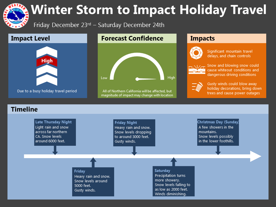
December 21, 2016 – Our forecast confidence continues to improve in a strong weather system moving through Northern California early Friday into Saturday.
This system is expected to cause substantial headaches to travel leading up to Christmas.
The greatest impact is for the mountains, where heavy snow with gusty winds and low snow levels will likely cause significant travel delays with potential whiteout conditions.
A few inches of snow are possible into the foothills late Friday night into Saturday.
Gusty winds are also expected for the Valley, but rainfall is expected to be less than with recent rainstorms.
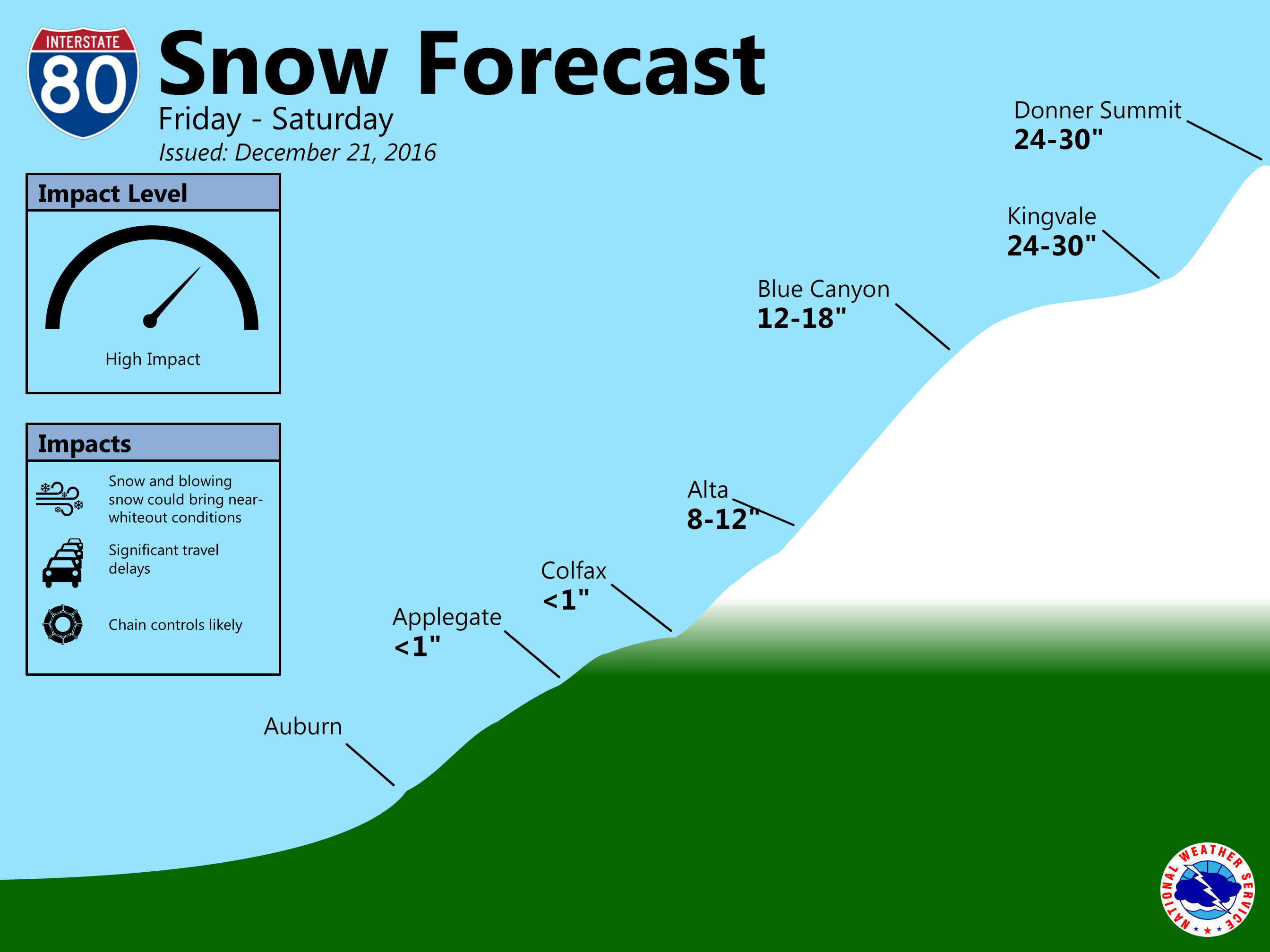
Impacts
- Significant travel delays, especially over the Sierra
- Snow and blowing snow could cause whiteout conditions at mountain passes
- Slick roadways could result in increased traffic accidents
- Gusty winds could bring down trees and cause power outages

Forecast Confidence
- High
Timing and Strength
- Best travel time Thursday
- Early Friday into Saturday (greatest impact Friday afternoon & Friday Night)
- Heavy snow with 1 to 3 feet possible. Snow levels initially 4500-6000 feet, potentially rapidly lowering to 2500-3500 feet Friday night.
- Light snow with 1 to 3 inches possible down into the foothills late Friday night into Saturday.
- Light to moderate precipitation across the Valley, heavy over mountains.