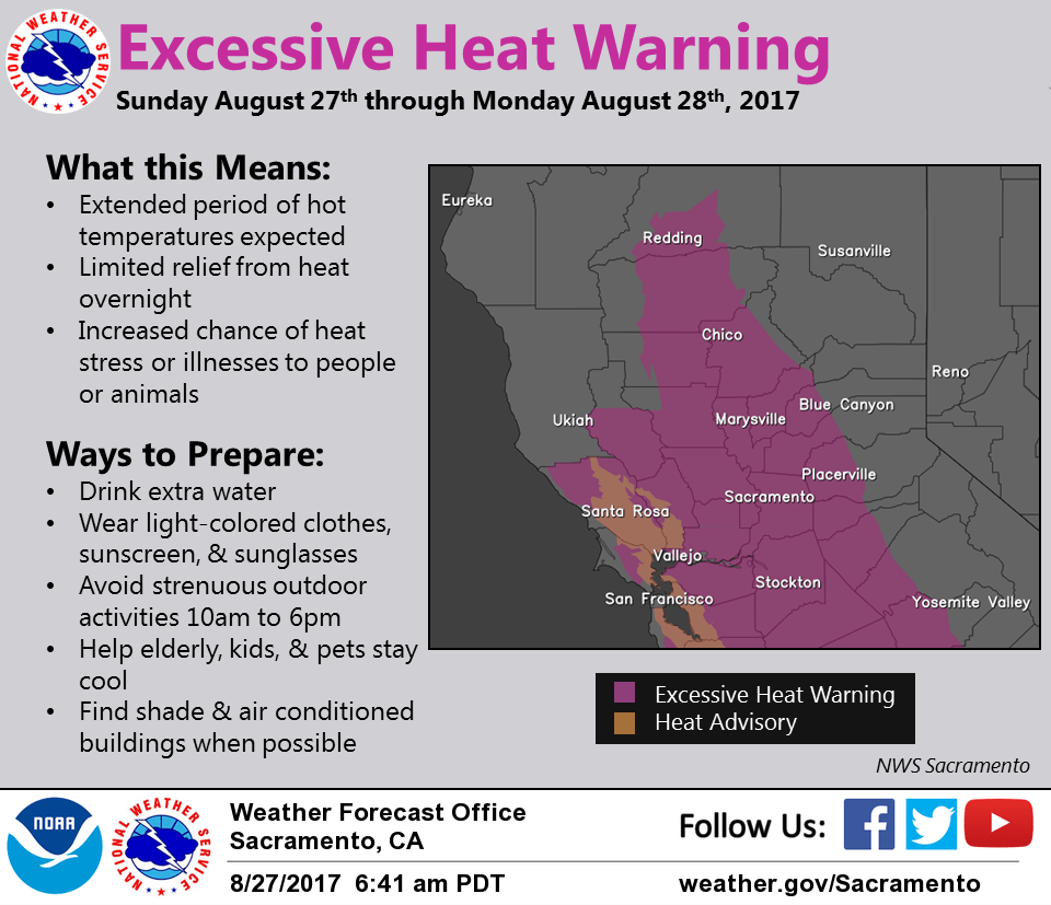
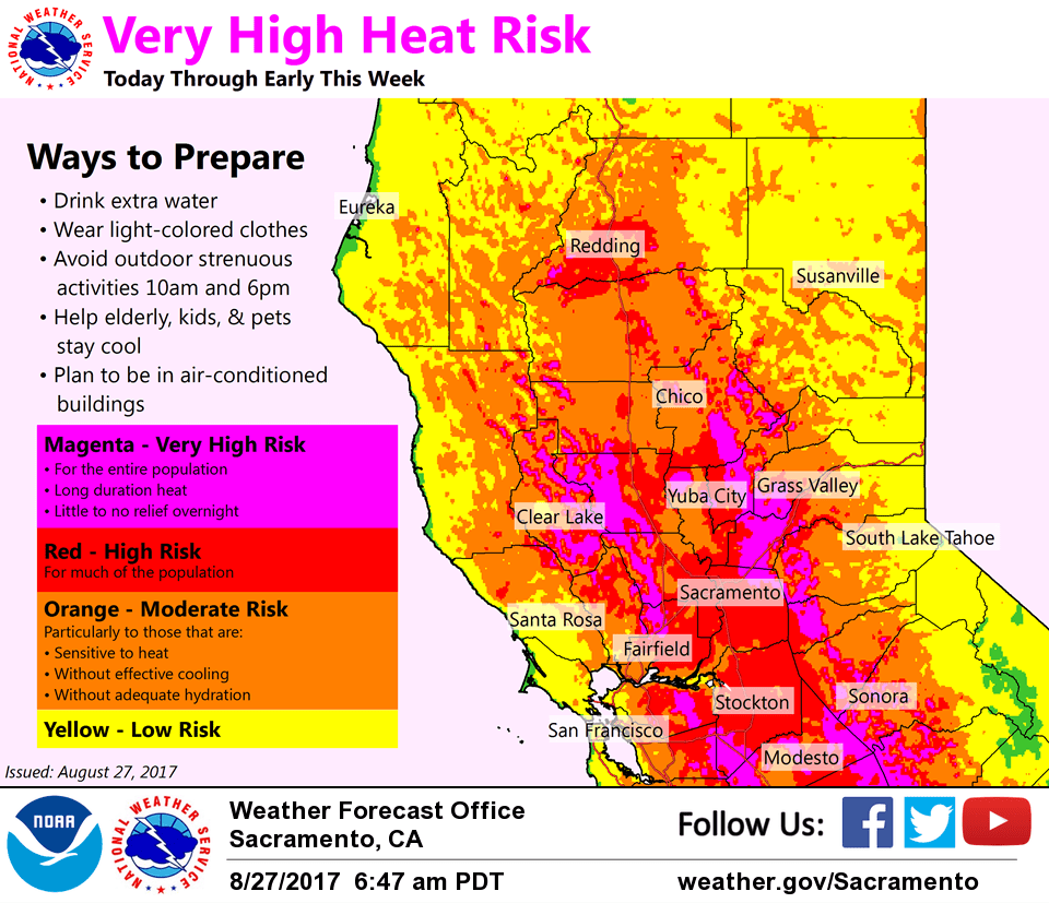
Very high heat risk continues across portions of interior northern California.August 27, 2017 – Hot weather continues across interior NorCal for at least the next week with record high temperatures possible the next few days. Slight chance of late-day thunderstorms over the Sierra Nevada south of Lake Tahoe on Tuesday and Wednesday. Excessive Heat Warning until 8 PM Monday.
Discussion
High clouds continue to move northward. Latest NAM is keeping some cloud cover around all day, mainly shifting them over the foothills and mountains for the afternoon hours. This may impact forecast high temperatures for some locations slightly. Models indicate the atmosphere is to stable so not concerned with thunderstorms developing today. Very weak flow through the delta will like stop for several hours later this morning through early afternoon.
Previous Discussion
Some cloudiness is working its way northward across the region early this morning, but most areas are seeing clear skies. Temperatures are considerably warmer across the region compared to 24 hours ago (most spots are running 5-10 degrees milder) and generally range from the mid 40s to mid 50s in the mountain valleys to the 60s and 70s elsewhere (except low to mid 80s in the thermal belts and along the east side of the Sacramento Valley).
Strong high pressure is forecast to dominate the region for at least the next week resulting in record, or near record, heat for the region as the marine layer is suppressed and onshore flow minimal. Overnight lows will also be on the warm side, especially in the thermal belts. The only break is expected Tuesday and Wednesday as a trough passing to the north brings a slight temporary cool down.
Enough moisture may work its way northward by Tuesday and Wednesday for a slight chance of late-day thunderstorms in the Sierra, mainly to the south of Lake Tahoe.
The hottest days early this week will be today and Monday with sites nearing or reaching record highs.
Extended discussion (Thursday through Sunday)
Upper level trough will shift eastward for the start of the long term forecast period on Thursday as strong upper ridging strengthens over interior NorCal. As a result, daytime highs will trend upward once again to near or record heat levels for this time of year late this week. Temperatures could be as much as 10-15 degrees above normal given a compressed marine layer and weak onshore flow. The strengthening high pressure system will keep stable conditions over interior NorCal. Some monsoonal moisture will try to work its way northward for the first part of the weekend but the strong high pressure on top of us may suppress any activity until later in the weekend.