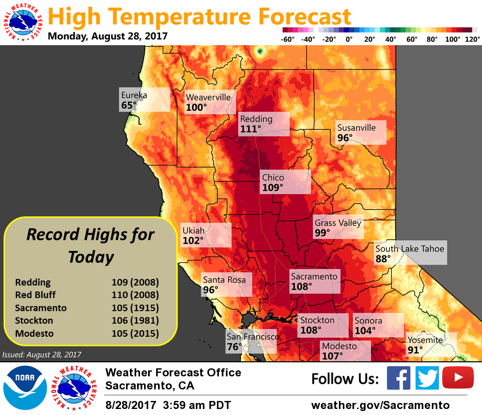
August 28, 2017 – Hot weather continues across interior NorCal for at least the next week with record high temperatures possible the next few days. Slight chance of late-day thunderstorms over the Sierra Nevada south of Lake Tahoe on Tuesday and Wednesday. Excessive Heat Warning until 8 PM PDT this evening.
Discussion
Strong high pressure continues with clear skies across much of the region early this morning. Current temperatures are running about the same as 24 hours ago across most of the area and range from the upper 40s in the mountain valleys to the lower 80s across the warmer portions of the valley and foothills.
Very hot weather continues with record heat expected again today. The marine layer is around 1000 feet deep and a weak Delta Breeze has returned, so areas in and near the Delta may see a few degrees of cooling today. Elsewhere, highs today are expected to be similar to Sunday’s as strong high pressure and light north to northeast flow continues. Warmest portions of the valley will once again be around 110 degrees this afternoon and an excessive heat warning remains in effect.
While still hot, temperatures will cool a bit Tuesday and Wednesday as a trough passing to the north of the region brings some synoptic cooling along with an increase in onshore flow. However, the cool down will be brief as high pressure quickly rebuilds later in the week.
Extended discussion (Friday through Monday)
Strong ridging will build back in to the region for Friday into the weekend. Once again, temperatures will warm with some daily records in jeopardy of falling. Daytime highs will be some 10-17 degrees above normal for this time of year with widespread triple digits across the Valley. Some type of heat product will likely be needed, especially given potential impacts on the holiday weekend. As ridging moves slowly off to the east by the end of the weekend, some monsoonal moisture may make a northward push toward NorCal. Might be enough to spark a thunderstorm or two across the Sierra south of Tahoe by Sunday afternoon, but low confidence at this point given strong capping that might be in place. Temperatures may cool slightly by Monday but still remain much above normal.