May 9, 2017 – Warming trend with diminishing north wind today. Turning cooler beginning Wednesday and more unsettled for the end of the week.
Discussion
Some high clouds are spilling across the eastern Pacific ridge into NorCal early this morning. Current temperatures are in the upper 20s and 30s in the colder mountain valleys with mainly 50s to lower 60s elsewhere.
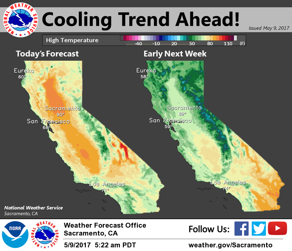
Today is expected to be the warmest this week for interior NorCal as the upper ridge moves overhead. Some locales in the Central Valley will reach the mid 90s this afternoon with lighter northerly flow expected.
Cool down commences Wednesday as onshore flow picks up across the region as the ridge shifts east of the area. Additional cooling expected Thursday as stronger synoptic cooling kicks in with the approach of the next trough. Highs on Thursday are forecast to be around 15-20 degrees cooler compared to those expected today.
Bulk of moisture will remain to the north across the PacNW but could see a few showers across the northern mountains Thursday and Friday.
Extended discussion (Saturday through Tuesday)
An upper level trough is expected to deepen along the West Coast, resulting in synoptic cooling and showers mainly over higher terrain. The air mass will cool as this system digs southward and reinforces the cooler temperatures. Therefore, below temperatures are expected during the extended period, with Valley highs reaching the upper 60s to low 70s. Extended models show a few differences in terms of timing and evolution of this system. Regardless, main dynamics should remain to the north, with best chance for showers over the mountains. Periods of breezy winds will be possible at times.