July 12, 2017 – Not as hot the next couple of days then hotter again this weekend. A slight chance of thunderstorms along the crest by this weekend.
Discussion
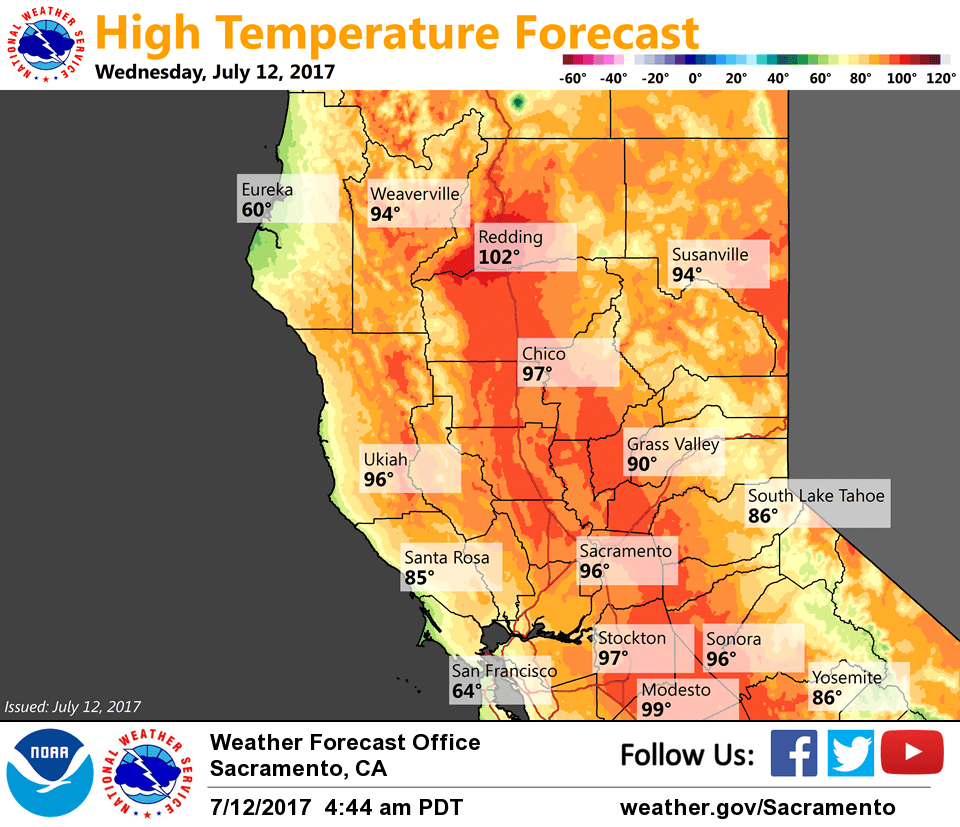
Clear skies across interior NorCal early this morning with less stratus along the coast compared to 24 hours ago. Current temps are cooler across most of the area compared to early Tuesday and generally range from the 40s in the mountain valleys to the 60s and 70s elsewhere with Red Bluff the warmest at 79.
The region will be caught between high pressure over the Southwest and low pressure off the PacNW the next couple of days. In general not a lot of change in temperatures the next two days for most areas other than the Delta influenced areas. Lack of stratus along the coast will allow for some changes around the Sacramento area. 850 mb temperatures cool slightly but that would most likely be offset by the slightly weaker flows through the Delta and warmer air in the Bay Area. Sacramento region may see some slight warming on Wednesday with little change from that for Thursday.
Not much chance for thunderstorms the next few days as southwest flow keeps deeper moisture and instability further to our south. Better chance of thunderstorms spreading north over the weekend as southerly flow increases with the upper air pattern amplifying.
Hotter temperatures forecast to return over the weekend, but enough onshore flow is expected to remain to keep things somewhat in check.
Extended discussion (Monday through Wednesday)
A trough of low pressure starting to deepen along the west coast on Monday will bring cooler temperatures to the region Monday through Wednesday with decent Delta Breezes each day. Temperatures will be cooling down to near seasonal normals. A stronger than normal jet for this time of year will move through the northwest part of the state late Monday and Tuesday and may bring some isolated thunderstorms north of our forecast area.