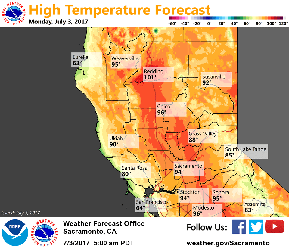
July 3, 2017 – Warm and dry this week except for a slight chance of late-day thunderstorms in the Sierra south of Lake Tahoe.
Discussion
Clear skies across interior NorCal early this morning as a weak short-wave passes to our north through the PacNW.
Current temps are similar to 24 hours ago and generally range from the mid 40s to mid 50s in the mountain valleys to the 60s to mid 70s elsewhere.
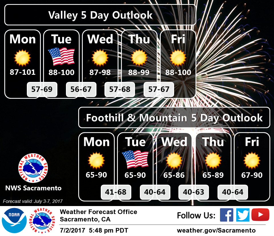
Little change in the weather expected across the region the next few days as the warm and dry pattern continues. Enough onshore flow will persist through the Delta to keep highs in check. Modest warming possible after mid-week as the southwest high is forecast to extend westward a bit compressing the marine layer and reducing onshore flow.
Late-day thunderstorm chances this week are forecast to be limited to the Sierra south of Tahoe, however upper-level moisture surge forecast by the models on Wednesday bears watching for the potential for elevated convection across the far southern and eastern portions of the forecast area.
Extended discussion (Friday through Monday)
High pressure will remain centered over the Four Corners region through much of the extended period, with SW flow aloft continuing over Northern California. The desert monsoon is projected to become more active in this timeframe, with a slight possibility of some monsoonal moisture reaching as far north as the Sierra near Yosemite Park. Temperatures are expected to be a bit warmer than normal during this timeframe, though onshore flow through the Delta will help to cool off portions of the Valley during the overnight hours.