March 31, 2021 – Dry conditions with much above normal temperatures through Thursday. Cooler, but still mild this weekend. Light precipitation may return early next week.

Discussion
Upper level ridge will remain over NorCal the next few days bringing dry conditions, light winds and much above normal temperatures. High temperatures for Valley locations will be generally in the low 80’s today, warming to the mid and upper 80’s Thursday.
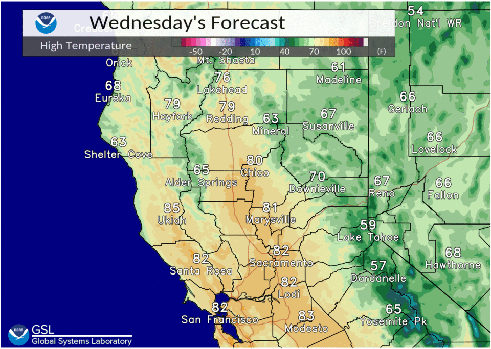
These readings are 15 to 20 degrees above normal for this time of year and could approach record levels at a few locations. Records are generally from 85 to 90 degrees Today and Thursday.
A series of troughs passing through the Pacific Northwest will flatten the ridge Friday into the weekend cooling the temperatures back into the 70’s, but these readings are still 5 to 10 degrees above normal.
Ensembles show a Pacific storm system possibly approaching the West Coast late Sunday and this could bring some increased cloud cover through the day.
Extended discussion (Sunday through Wednesday)
Dry weather expected Sunday as upper ridging moves into the Great Basin and upstream Pacific storm approaches. Models continue to differ with handling of this system both in strength and progression.
Forecast leans towards GEPS/GEFS ensemble solutions with precipitation, mainly light, spreading into the CWA Sunday afternoon into night. Progression of upper low is not modeled well but appears to linger near the coast Monday into Wednesday with unsettled weather through the period.
High temperatures expected to be near to slightly below normal through the extended forecast period.