September 8, 2017 – Warming trend with a threat of afternoon showers and thunderstorms over portions of the mountains through early next week.
Discussion
People will be waking up to a cool morning. 4 am temperatures were running 4 to 11 degrees cooler than 24 hours ago as the low pressure trough is moving into the west coast. Models are showing that trough will transition into a closed low later today and hover near the California coastline during the short term forecast period which goes through Monday.
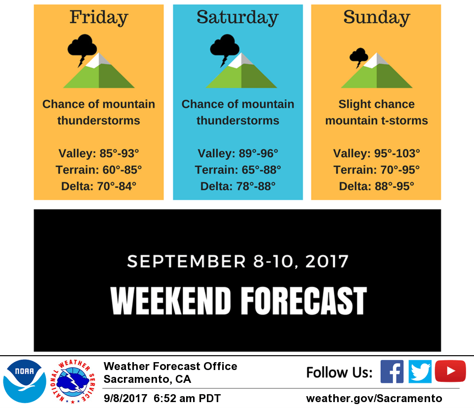
So here’s what we can expect as this low impacts our region. The primary concern is thunderstorm activity over the Coastal and Sierra mountains. Any thunderstorm development will impact outdoor workers or recreationalists in higher terrain with the threat of lightning, brief & heavy downpours, erratic gusty winds and small hail. In addition, lightning strikes will increase the potential for new fire starts since fuels are very dry in NorCal and the winds could increase fire spread. Today, the low will enhance instability up and down the Sierra as well as over the Coastal Range north of Lake County. The HRRR model shows that the most likely timing of thunderstorms will be between 2 pm and 8 pm today. Once the trough becomes a closed low, it will gradually track southward along the CA coastline. This means the best chance for thunderstorms Saturday into Monday will be more over the Central and Southern Sierra.
Daytime highs will warm up a bit today and that warming trend continues through the weekend. Max temperatures today will be near seasonal becoming 5-10 degrees above normal for Sunday and Monday. Valley highs will range upper 80s to mid 90s today and tomorrow becoming upper 90s to low 100s Sunday and Monday. For higher terrain, highs today and tomorrow will be 70s-80s then mid 70s to low 90s for Sunday-Monday.
Extended discussion (Tuesday through Friday)
Both the ECMWF and GFS are in good agreement, bringing the upper low inland over central CA toward the middle of next week. Widespread showers with some embedded thunderstorms seem like a reasonable bet. Best chance of this convection will be over the mountains, but the dynamics of this system would suggest potential for low elevation thunderstorms as well.
Drier weather is projected toward the end of next week under a dry upper trough. Temperatures are forecast to be around or slightly cooler than normal during this timeframe.