January 14, 2021 – Dry weather into next week with areas of late night and morning valley fog. Well above average temperatures into next week.
Discussion
Other than a few high clouds spilling into NorCal over the amplifying ridge along the West Coast, skies are clear across the region. IR difference imagery shows fog entrenched across the mountain valleys over the southern Cascade Range and far northern Sierra, and is beginning to indicate fog development along the eastern edge of the northern San Joaquin Valley (east of Stockton and Modesto) where northwesterly winds have subsided.
Northerly surface pressure gradients are weakening, and northwest winds in the Sacramento Valley are forecast to diminish over the next several hours (especially over the eastern half of the valley). Dew points remain high, in the mid 40s to around 50, so fog is expected to become more extensive across the Central Valley around sunrise with areas of dense fog possible from about the Yuba City area southward into the San Joaquin Valley potentially affecting the morning commute across the Sacramento and Stockton/Modesto region.
Otherwise, dry and mild weather is expected across the region through the weekend as high pressure dominates. High temperatures will be well above average (around 10-20 degrees), and several daily records will be in jeopardy each day. Also, areas of late night and morning valley fog will be possible, but northerly winds in the Central Valley each day will be a potential mitigating factor.

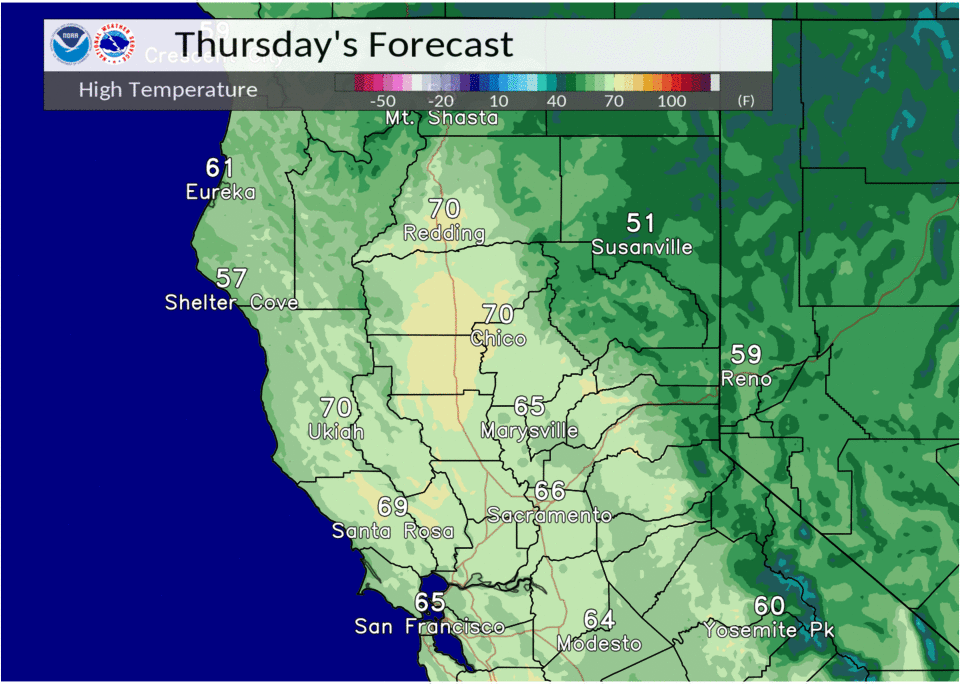
Extended discussion (Monday through Thursday)
Ensembles are in good agreement tonight with a short wave trough tracking through NorCal early Monday. This short wave trough will then begin to close off over SoCal later Monday into Tuesday as the Pacific ridge builds in. This will bring an increased pressure gradient over NorCal and we can expect breezy north and east winds. The gradient will loosen up later Tuesday into Wednesday and we will be on the eastern edge of the Pacific ridge. The ridge will push west late next week as a short wave trough digs down the coast. This may bring some light showers to the area, otherwise dry weather is expected throughout the period. Above average highs will continue with them starting out 10-15 above average and cooling to 5-10 above average by the middle of next week.