September 5, 2016 – Clear skies across the region early this morning as the weekend trough departs further to the east. Temperatures are running pretty similar to 24 hours ago and generally range from the 30s in the colder mountain valleys to the 50s to mid 60s elsewhere.
Warming returns to the region today as ridging from the eastern Pacific extends into NorCal and mostly light northerly flow develops. The last “little bit” of energy will work southeastward today on the back side of the exiting trough. Highs today will be close to average for early September.
Heights aloft and thickness rise through mid-week as the ridge builds, and with generally light northerly surface flow, temperatures will continue to warm. Readings will be back to above average as early as Tuesday with portions of the valley challenging the century mark by Wednesday.
Extended discussion (Friday through Monday)
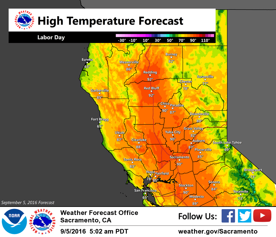
Dry weather and warm temperatures expected for the end of the work week through the weekend as weak high pressure remains in control. Temperatures will be a few degrees above normal with locations in the northern Valley near the triple digit mark. 90s elsewhere in the Valley with 70s/80s across higher elevations. Winds at this point look relatively light and terrain driven, although could be a bit breezy at times over the weekend as onshore flow strengthens.