High pressure strengthens this weekend bringing a return of very hot weather into next week, particularly for the northern and central Sacramento Valley.

Discussion
Upper low that produced yesterdays mountain thunderstorms is in the process of weakening as it passes through NorCal and not much will be left by this afternoon. This will also allow the onshore flow to diminish, which will cause a rapid warm up through the weekend. Instability has greatly diminished with new model runs and isolated thunderstorm threat will be confined to near the crest of Tuolumne county this afternoon.
Strong upper high over the Pacific northwest in omega blocking pattern will result in a region wide warming. Triple digit heat will return to northern California today with further warming through the weekend. Highs of 105 to 111 degrees are expected over the Northern/Cent Sacramento Valley.
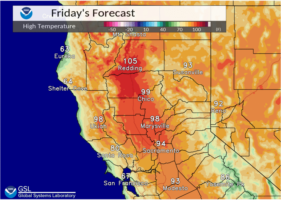
Warm lows in the 70s to around 80 will provide little or no overnight relief. A combination of the very hot afternoons and warm nights will result in a period of high to very high heat risk that will impact the northern and central Sacramento Valley, as well as the adjacent foothills. Consequently, an Excessive Heat Warning is in effect from Saturday through next week Wednesday evening for these areas.

There has been a trend to cooler temperatures Monday through Wednesday and there is some chances a few areas may drop below excessive heat levels early next week.
Upper low encroaching on the west side of the high off the Eureka coast will initiate just enough flow from the bay area to keep the Delta, Southern Sacramento and Northern San Joaquin valleys out of the excessive heat warning, where temperatures will generally be from 95 to 100 degrees for highs into early next week.
Extended discussion (Tuesday through Friday)
Ensembles continue to show upper level ridging over the Pacific Northwest next week, with well above normal temperatures. Weak upper low pressure along the coast will continue some onshore flow. Because of this, highest temperatures continue over the northern and central Sacramento Valley, away from any Delta Breeze influenced areas. NBM high temperatures for Redding and Red Bluff for Tuesday-Friday have trended a little less hot, though, around 103-105.
Because of this, heat risk now looks like it will fall more into the moderate level. High temperatures there are expected to remain around 104-108, locally hotter.
The heat risk near the Delta, southern Sacramento Valley, and northern San Joaquin Valley will drop into the moderate to low category next week, with onshore flow bringing some more cooling.
The weather is expected to remain dry over much of the area through the extended. The exception is over the northern Sierra south of Highway 50, where some subtropical moisture advecting northward could bring afternoon showers and thunderstorms Tuesday through Friday into that area.