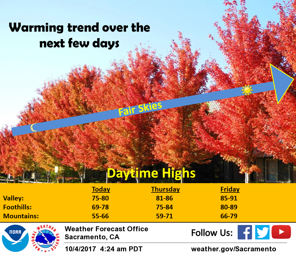
October 4, 2017 – A warming trend through the end of the week with daytime highs climbing to a few degrees above normal by Friday. Dry with breezy north winds early next week for increased fire danger. Slightly cooler temperatures.
Discussion
Upper low over the northwest U.S. continues to shift to the east with upper low center currently over western Nevada. Northerly surface gradient across the northern CWA is significantly lighter than 24 hours ago so winds over the northern Sacramento valley much lighter than Tuesday morning. As a result, temperatures over the northern Sacramento valley are significantly cooler this morning. Elsewhere, most locations are seeing temperatures a few degrees warmer this morning.
Upper low remains over the northwest U.S today but stable northwest flow aloft should keep any precipitation chances out of the forecast area today. Most locations should see a slight warm up this afternoon under a slightly warmer airmass.
Upper ridging over the west coast on Thursday will bring more warming with daytime highs climbing to near normal.
Temperatures continue to warm on Friday as high pressure slides over the west coast with daytime highs climbing to a few to several degrees above normal. Upper level low pressure system digging into the northern U.S. flattens the west coast ridge on Saturday. This should level off daytime highs or cool them slightly with highs going into the weekend a few degrees above normal.
Extended discussion (Sunday through Wednesday)
Area will be sandwiched between high pressure off the West Coast in the Pacific and troughing digging from the Great Basin into the Rockies. This will continue dry weather with increasing northerly flow. Winds will become quite breezy Sunday into early next week with low humidity values again. This will likely lead to another period of critical fire weather conditions. Above normal temperatures Sunday with valley highs in the mid 80s and 60s to 70s in the mountains. Temperatures will cool Monday and Tuesday with near normal highs expected.