August 15, 2017 – Temperatures remain below average today, then warming back to near or slightly above average beginning Wednesday. Slight chances for late-day mountain thunderstorms.
Discussion
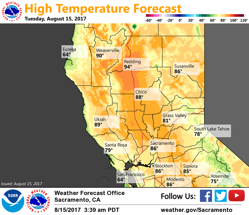
Skies have cleared out across interior NorCal. Current temps are running about 5-10 degrees cooler compared to 24 hours ago and range from the 40s in the mountain valleys to the upper 50s to around 70 in the Central Valley.
Several impulses forecast to drop southeast into NorCal thru Wednesday as the trough shifts east and ridging from the eastern Pacific begins to rebuild. Along with daytime heating of terrain, these impulses may provide enough kick for a few late-day thunderstorms, mainly south of Lake Tahoe, the next few days.
Temperatures today will remain below average, but are expected to edge up a few degrees compared to Monday’s readings. Temps will be back to around average, or slightly above, beginning Wednesday.
Extended discussion (Saturday through Tuesday)
Upper level troughing will move onshore for the weekend and linger into at least the middle of next week. Several shortwaves will draw moisture northward, allowing for isolated thunderstorms each afternoon/evening near the Sierra crest, mainly south of Lake Tahoe. This will also keep temperatures within a few degrees of normal, quite pleasant for mid-August. Early forecasts for Monday suggest mostly clear skies for viewing of the partial solar eclipse in interior NorCal.