
December 7, 2016 – A return to wetter weather will commence later today and continue into next week.
Discussion
Other than some high clouds spreading in ahead of the next weather system, skies are generally clear across interior NorCal early this morning. Light northerly winds are keeping temperatures up along the west side of the Sacramento Valley, but elsewhere readings are chilly. Current temperatures range from the single digits to 20s in the mountains with mainly 30s across the lower elevations (the east side of the Sacramento Valley is in the upper 20s and lower 30s).
With the colder and drier airmass, and a little bit of wind, fog is much less prevalent in the valley this morning. However, there are some patches.
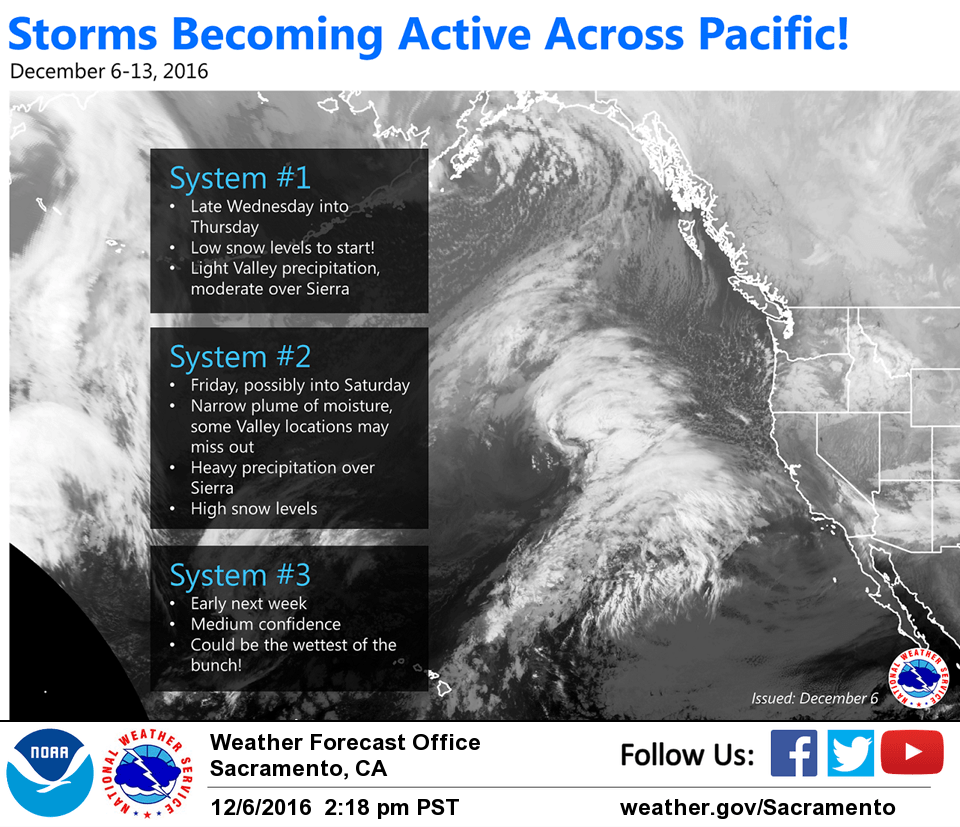
A transition back to a more active weather pattern (precipitation-wise) begins later today as a series of more substantial systems begin to affect the region. Because of the cold air already in place, expect snow levels to be rather low when the first system arrives by this evening.
In Shasta County, snow levels could be in the 1000-1500 ft range, and 2500-3000 ft along the Sierra foothills. Precipitation is generally expected to be light in those locations. Depending on location, this cold air will be slow to mix out Wednesday night into Thursday, especially in the northern mountains. Strong warm- advection may be more successful in bringing rising snow levels in the northern Sierra by later Thursday.
Additional impulses arrive Thursday & Friday, possibly into Saturday. This will come in the form of a narrow plume of moisture, so some locations may miss out on precipitation with those impulses. The Sierra will likely see heavier precipitation with those waves with high snow levels.
Extended discussion (Sunday through Wednesday)
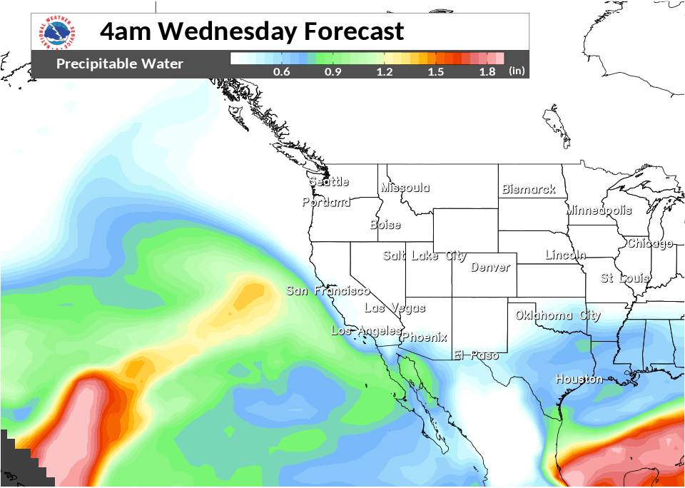
An active, large scale pattern will continue through the extended forecast with an abundant moisture tap. The mid to upper level pattern is quite zonal, and it is difficult to determine any definitive breaks in the steady moisture tap this far out.
Guidance suggests a brief lull in precipitation occurs Saturday night into early Sunday before the next system moves in later in the today and continues with the precipitation ebb and flow into mid next week. There are differences in timing and evolution of this system as the GFS is the fastest and more moist solution. Regardless, widespread precipitation can be expected across the forecast area. The longer Sunday to Wednesday period appears to have a more plentiful moisture tap than the upcoming, shorter Thursday to Saturday event, and you would expect increased forecast accumulations. However, this is not the case because we had to compromise due to the GFS vs ECMWF precipitation differences. The GFS has been the wetter model the past couple days, but the ECMWF has been consistently drier. Nevertheless, stay tuned for updates, as forecast amounts for next week could increase over time. Snow levels are around 3500 feet across northern mountains and 4500 to 5500 feet in the Sierra on Sunday, then increasing into Tuesday with the warm air advection.