July 7, 2017 – Hot and dry through the weekend. Isolated thunderstorms possible near the crest and mainly south of Lake Tahoe this afternoon.
Discussion
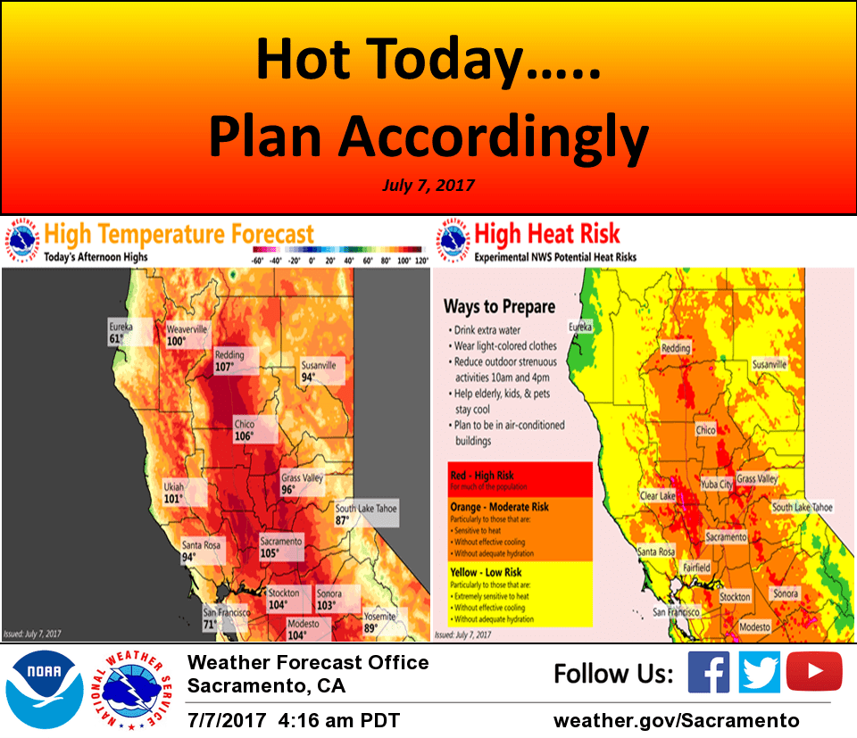
Strong high pressure centered over the 4-Corners through the weekend will give NorCal a 4 day heat wave in the Sac area and about a 6 day heat wave in the northern Sacramento Valley with triple digit max temps. Max temps will be a little hotter today than yesterday with many highs reaching/exceeding 105 degrees in the valley with the north end of the valley nearing 108 to 110. These max temps are a few to several degrees below the record highs for the date. Deep vertical mixing today will likely cause an increase in area fire activity, with less mixing (lower mixing heights) forecast over the weekend.
Although today will likely be the hottest day for the Sac area, the heat will continue in the northern end of the Valley through the weekend and into early next week. Slight cooling is forecast each day in the Delta influenced areas as 5H heights lower in advance of an approaching Pacific trof. The trof should rejuvenate the Delta Breeze Mon morning possibly bringing some stratus into the inland areas along with cooler temps.
Elevated instability charts suggest isolated thunderstorms will be possible near the Sierra Crest mainly south of Tahoe today as southerly flow continues around the 4-Corners High, and advects some monsoon moisture northwards. The activity should shift east of the Sierra Crest over the weekend as the steering flow shifts southwesterly.
Extended discussion (Tuesday through Friday)
For Tuesday and Wednesday, an upper level trough will push into the Pacific Northwest and NorCal allowing for daytime highs to cool slightly. Slight chance of thunderstorms could occur over the Sierra south of Highway 50. The Desert SW ridge building westward toward CA Thursday and Friday, increasing temperatures.