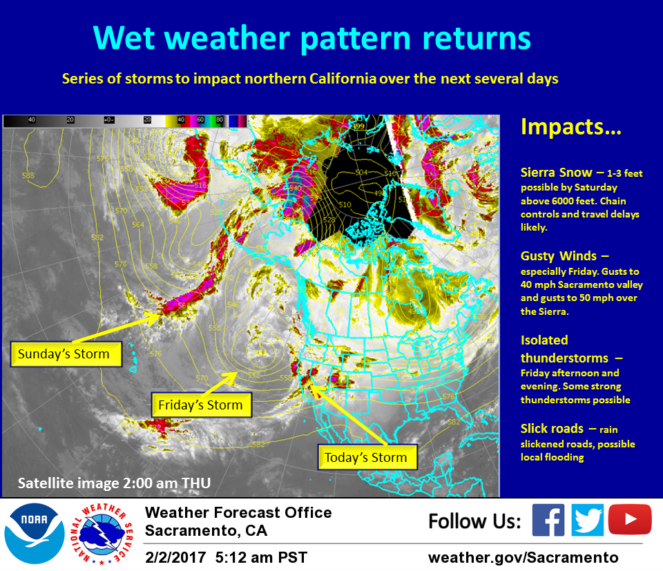
February 2, 2017 – Wet pattern returns today with rain and mountain snow today and Friday. Gusty winds Friday. Showers Saturday will be followed by another round of heavier precipitation Late Sunday. Wet pattern continuing through next week.
Discussion
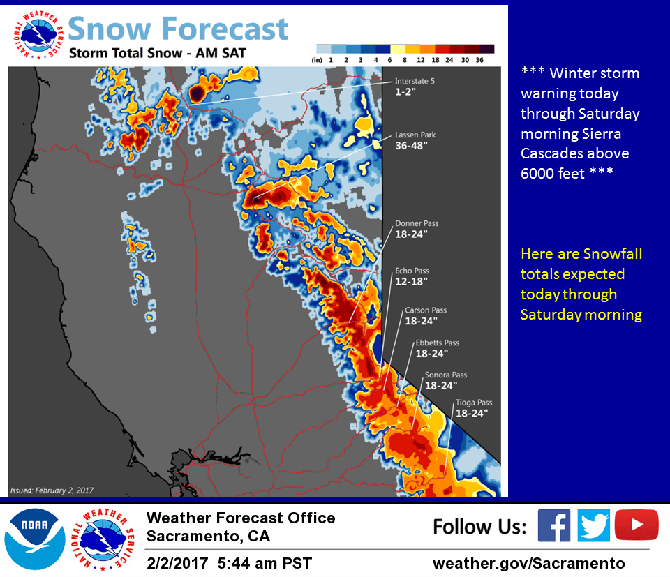
First in a series of Pacific frontal systems is now pushing on to the coast bringing rain to the coast range. Ahead of this system a shortwave disturbance is currently bringing light precipitation from about Sacramento southward as it pivots to the northeast in warm sector southwest flow. The initial front swings across NorCal today bringing heavier rain and mountain snow. Snow levels are expected to be moderately high but low enough to impact Sierra travel.
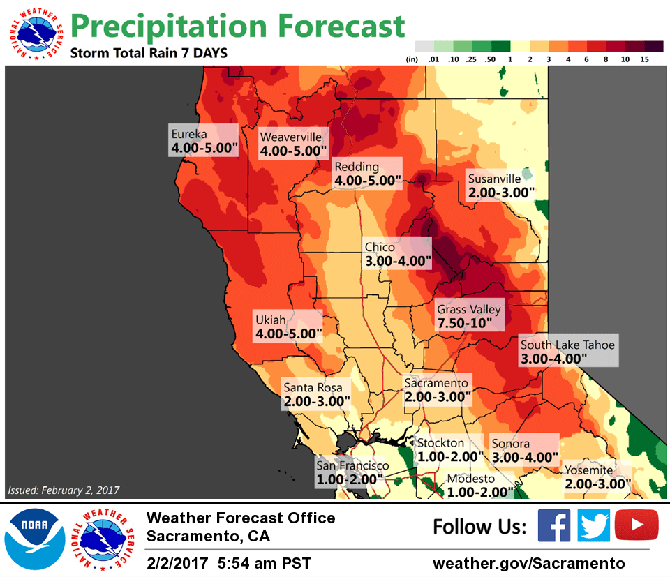
The main upper low now centered near 39N 137 W will quickly pivot another frontal band through NorCal on Friday. This system will also contain moderate rain and mountain snow with moderately high snow levels but will also likely be a windier system.
Projected surface gradients from SAC to MFR top 10 mb on Friday which should be sufficient to generate wind advisory winds in the Sacramento valley and foothills. Have therefore issued a wind advisory for this area for most of Friday.
Upper shortwave passes through NorCal Friday afternoon bringing enough instability for a threat of thunderstorms especially to the northern Sacramento valley. NAM and GFS both showing low level shear so worth watching models for severe thunderstorm potential Friday afternoon.
Flat, moist southwest flow continues on Saturday for a continued shower threat during the day Saturday.
Sunday could start out dry but next Pacific system moves quickly to the coast by Sunday afternoon. Moderate precipitation is likely to return to NorCal by Sunday night with another round of moderately strong winds.
Extended discussion (Monday through Thursday)
Models showing wet weather continuing Monday through Thursday of next week. Pacific cold front moves through Monday followed by overrunning warm frontal precip Tuesday into Wednesday.
Another strong cold front moves through Thursday into Friday. Snow levels expected around 5000 to 6000 feet Monday, rising Tuesday into Thursday above pass levels.
Gusty wind at times can be expected through the extended forecast period with high temperatures slightly above normal beyond Monday.