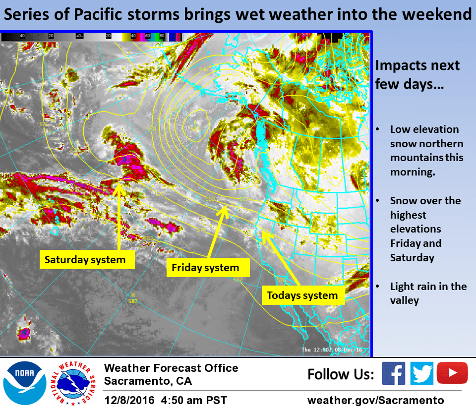
December 8, 2016 – Wet pattern through the weekend as a series of weather systems move through northern California. Moderate snow levels expected. Periods of rain and mountain snow possible for first half of next week.
Discussion
Northern California currently in a showery period between weak weather systems. Current snow levels over the northern Sierra have climbed to 5000 feet an continue to rise. Farther north over Shasta county, trapped cold air has been slow to mix out under light wind conditions.
Airmass supports much higher snow levels so expect low level colder air to mix out later this morning after sunrise. Until then, have left up winter weather advisory for Shasta county mountains.
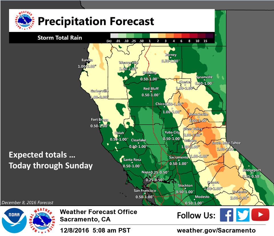
Next weak frontal system now along the coast will be pushing across the state today reaching the Sierra by this afternoon. Generally light amounts of precipitation are expected in the valley with this system but orographics will bring higher amounts over the Sierra Cascade crest. At this time, snow levels are expected to rise to mainly above pass levels by later this morning.
Cloudy skies and cool airmass will keep today’s highs below normal.
Zonal flow will bring the next Pacific system into NorCal on Friday keeping the precipitation going. This system looks similar in strength to today’s system with light rain over the valley and orographics bringing moderate rain to the Sierra Cascades. Snow levels with this system remain near to a little above pass levels so impacts to trans Sierra travel should be minimal.
A slightly colder weather system is forecast to move through the north state Friday night and Saturday. The lower snow levels could produce more significant travel impacts over the higher terrain so possibility of winter mountain travel products will need to be accessed as Saturday grows closer.
Sunday could see the biggest gap in precipitation of the next several days with models showing NorCal in between systems. Moist zonal flow, however, will keep the threat of showers going through the second half of the weekend. At any rate, precipitation amounts will remain light Sunday.
Extended discussion (Monday through Thursday)
Low-confidence forecast for NorCal precipitation early next week as models generally generally build a flat ridge across the area by Tuesday. EC and GFS operational runs have flipped, and the EC is now the wetter solution with moisture moving up from the southwest resulting in widespread precipitation for the area while the GFS is dry.
Better confidence in another more significant precipitation event for the region later next week as the ridge is displaced eastward by a deeper trough showing potential for merging polar and subtropical flow over the eastern Pacific.