February 14, 2017 – Dry weather continues today. Yet another round of wet weather arrives Wednesday with several rounds continuing into next week.
Discussion
Skies have cleared out for the most part overnight. Temperatures are running a bit cooler across much of the region and generally range from the upper teens and 20s in the mountain valleys to the 40s in the Central Valley.
Valley fog may develop early this morning as many spots are nearing saturation, or already there, but will likely only be patchy. Otherwise, dry weather with mild temperatures will continue today.
Some light warm-advection precipitation may develop later Wednesday across far northern California, but much of the region will remain dry through Wednesday as well.
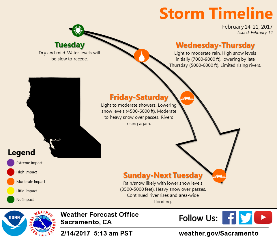
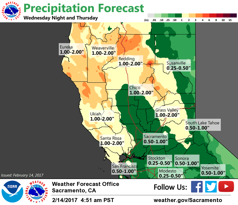
Heavier precipitation is currently expected to move through NorCal late Wednesday night and Thursday morning. Precipitation from this first storm will be focused north of I-80 where the Sacramento Valley may see 0.50 to around an inch while the foothills and mountains receive around 2-4 inches. Amounts to the south of I-80 will be lighter.
Snow levels will initially be quite high (7-8K ft or higher) Wednesday night, but will lower to around 5-6K ft on Thursday. The northern Sierra Nevada pass levels may see around 6 inches of snowfall accumulation by Thursday evening while the higher peaks could receive a foot or more.
It’s looking like the brunt of Friday’s storm is heading toward SoCal with lighter QPF and not as much wind for NorCal. However, with snow levels remaining around 5-6K, winter weather impacts may increase across the higher elevations of the northern Sierra Nevada.
Extended discussion (Saturday through Tuesday)
Series of storms forecast to impact Norcal through this extended period. After the filling upper level low elongates and passes to the south on Friday, it splits Saturday with a weak trough overhead. Precipitation will diminish Saturday, but pick up Sunday with another weak wave, and even more with a wetter, more dynamic storm Monday into Tuesday. These storms will be cooler than the short term systems, between 4000 and 5000 feet.
An early estimate of precipitation amounts for the extended suggests 3-5 inches over the mountains and 1 to 2 inches in the Valley with 1-3 feet of snow above 5000 feet and up to 4 feet over western Plumas and Sierra counties. Periods of gusty southerly winds will also be possible Monday into Tuesday to mix things up a bit.