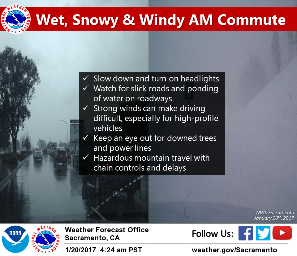
January 20, 2017 – Next in series of winter storms moves through NorCal today bringing rain, mountain snow and strong winds. Showers Saturday followed by a slightly stronger system Sunday into Monday. With these storms, expect mountain travel impacts due to snow and winds and moderate to heavy rain at the lower elevations with windy conditions. Winds could become damaging at times. Should see extended dry period for the middle to end of next week.
Discussion
Pacific frontal band appears to be moving on to the coast at this time with post frontal showers and isolated thunderstorms being detected off the coast. At this time, nearly all of the CWA is seeing light warm sector precipitation. MFR to SAC surface gradient over 10 mb this morning with the northern Sacramento valley seeing sustained winds topping 20 mph. These winds will shift southward as the front moves inland so have left up wind advisory for the valley. Moderate snow falling over the Sierra at this time with breezy winds so winter storm warning still looks good there. Current forecasts give 2 to 3 feet of new snow between now and Saturday morning. Snow levels across the northern mountains appear to be around 3000 to 3500 feet.
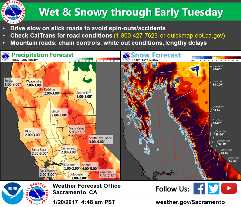
This may make for some slick roads that rise to that elevation so have left snow advisory for northern mountains and coast range up as well. QPF with this system not high enough to expect significant areal flooding but local flooding remains a possibility. Frontal passage through the Sacramento area expected later this morning with decreasing winds by mid day.
New weather concern then becomes afternoon thunderstorms with projected instability behind the front for thunderstorm threat in the valley. This threat will continue through early this evening but should end by late evening as upper trough shifts east of the region. Weak ridging slides over the state Saturday but plenty of moisture continues to slide over the ridge so showers will continue Saturday.
Although QPF drops significantly tonight, orographics keep snowfall going over the west slopes of the Sierra Cascade range. This break is relatively short with next strong frontal band moving into the state late Saturday night. This brings another round of rain and mountain snow with significant ramp up in snow over the Sierra. Since the slowdown in Sierra snowfall Saturday afternoon and evening is so short…have extended the winter storm warning for the Sierra Cascade range to include the Sunday storm. This storm, which is forecast to move through NorCal through the day on Sunday will bring another round of heavy precipitation, mountain snow and possibly even stronger wind than today’s storm. Not sure yet about thunderstorm potential Sunday afternoon as the brunt of the storm may still be crossing the valley during the max heating part of the day. This system passes east of the CWA by late Sunday night but showers continue on Monday with models consistent in dropping a cold low down the coast. If this scenario pans out then valley thunderstorms are likely to return during the day Monday.
Extended discussion (Tuesday through Friday)
Extended period of dry weather expected across the region during the extended forecast period as models continue to show strong ridging developing along the West Coast. Cool nights and mild days with this dry pattern.