February 1, 2017 – Dry with patchy morning valley fog today. Wet pattern returns tonight with heavier rain and mountain snow Thursday and Friday. The wet pattern may continue into next week.
Winter Storm Warning from 10 PM this evening to 4 AM PST Saturday for West Slope Northern Sierra Nevada-Western Plumas County/Lassen Park.
Wind Advisory from 4 AM to 10 PM PST Thursday for Carquinez Strait and Delta-Central Sacramento Valley-Clear Lake/Southern Lake County-Motherlode-Northeast Foothills/Sacramento Valley- Northern Sacramento Valley-Northern San Joaquin Valley-Southern Sacramento Valley.
Discussion
Ridge is shifting east and high clouds have increased across NorCal overnight. Some patches of fog again early early this morning as many valley locales are at or near saturation. Temperatures are pretty similar to readings of 24 hours ago and vary from the teens and 20s in the mountain valleys to the upper 30s and lower 40s in the valley.
Weather conditions today will be pretty similar to Tuesday with varying amounts of high clouds moving overhead. High temperatures will once again be in the 50s to around 60 across the Central Valley.
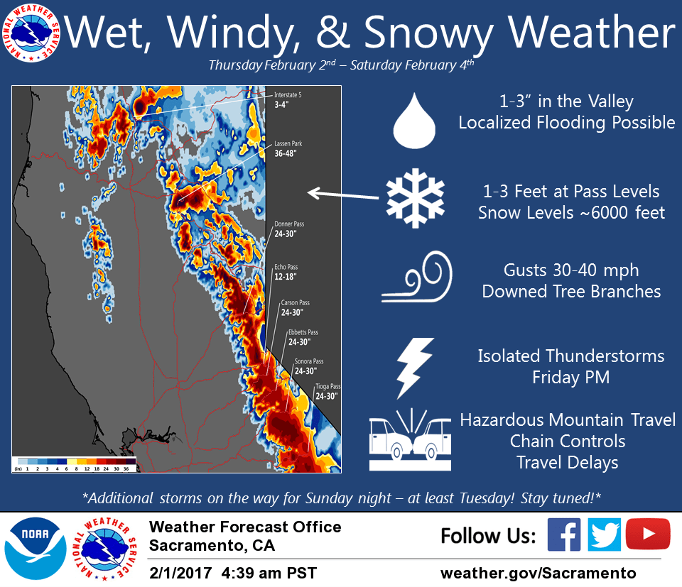
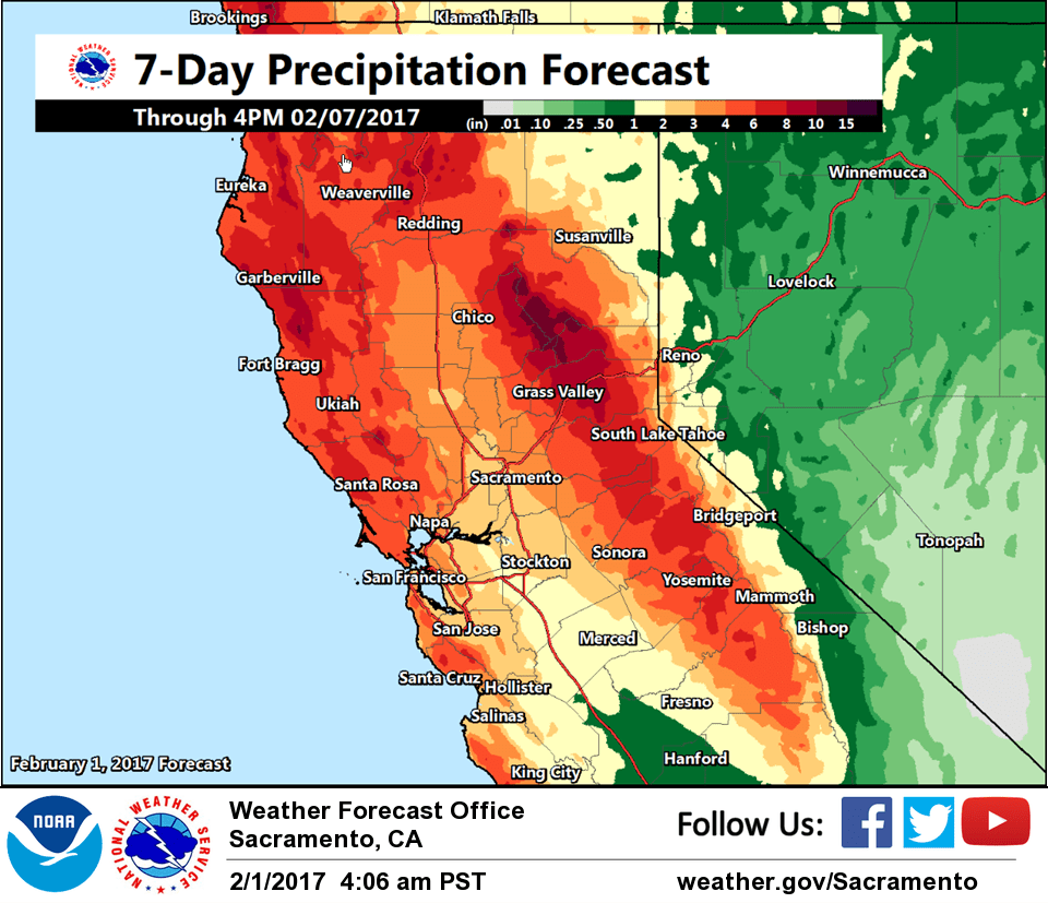
An approaching upper low and associated frontal system in the eastern Pacific will bring a return of wet weather to NorCal starting tonight and continuing into the weekend. By Friday, an inch or two rain will be possible in the valley with 2-3 feet of snow at the higher elevations of the northern Sierra Nevada and southern Cascade Range.
Gusty southerly winds will also develop across the region on Thursday and again Friday. Post-frontal showers are expected Friday and a few thunderstorms cannot be ruled out for the afternoon. Showers will likely end in the valley Saturday while tapering off in the mountains.
Extended discussion (Sunday through Wednesday)
Unsettled pattern continues through the extended period with a few changes made to Tuesday-Wednesday timeframe as 00z model runs have come in much wetter/warmer.
Period begins Sunday with brief ridging across the area. Quick break in precipitation expected for most of the area during the day, although a few showers may continue across the mountains. Additional accumulations will be light. Longwave trough then drops southward and deepens along the West Coast Sunday night into Monday. Still some model differences in strength of this system, but solutions are in general agreement to lend higher confidence in widespread precipitation across the area. Snow levels will be around 6000 feet with moderate accumulations possible and hazardous mountain travel conditions. System could also bring another round of gusty winds.
Earlier model runs were advertising colder air spilling in behind trough on Tuesday. However, as mentioned above, 00z runs have come in wetter and warmer with another system following quickly in the wake of Monday’s system. This would lead to additional widespread precipitation across the area Tuesday into early Wednesday. If current solutions pan out, snow levels would be rising throughout the event and may be above pass levels by late Tuesday. Lower confidence in this system right now as it’s still a ways out but have nudged precipitation chances, temperatures, and snow levels upwards to match latest trends. Something to keep an eye on going forward.