May 27, 2021 – Dry weather with temperatures near or above average through the week. Hot conditions will develop early next week.

Discussion
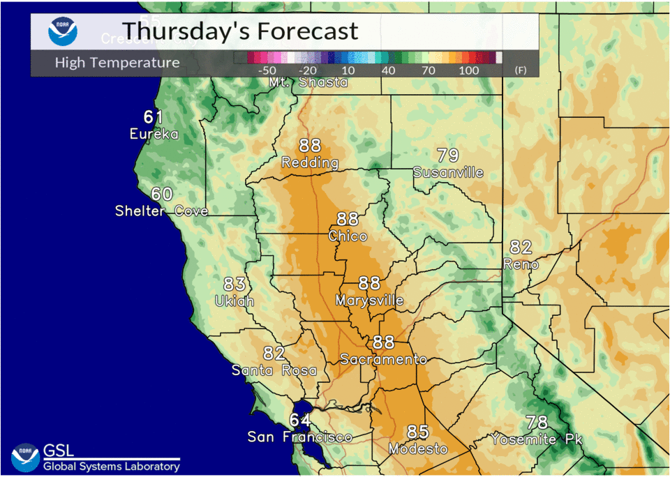
Other than a few thin high clouds entering northwest California ahead of the next trough, skies are clear across interior NorCal early this morning. Surface pressure gradient has begun to trend onshore, and local cooling from an increased Delta Breeze has spread inland to around the Sacramento area and across the northern San Joaquin Valley. Current temperatures range from the 30s in the colder mountain valleys, to the 50s in the Delta Breeze influenced areas of the Central Valley (mild 60s to lower 70s elsewhere in the valley).
Trough will pass to the north across the PacNW today, and only minor cooling and a few clouds are expected across interior NorCal.
For Friday and Saturday, temperatures will creep back up by a few degrees from Thursday as the PacNW system lifts into Canada. A weak disturbance is forecast to develop west of the California coast, and will help to keep some moisture in place across central California. A short-wave dropping into the Great Basin on Saturday may provide enough lift to pop a few late day thunderstorms along the northern Sierra crest, mainly to the south of Lake Tahoe.
Strong high pressure builds into NorCal Sunday. Any remaining Delta Breeze will be eliminated as northerly surface flow develops. This will mark the beginning of a stretch of triple digit heat for the Central Valley that will continue into the middle of next week.
Extended discussion (Monday through Thursday)
Extended forecast looks to be on track as upper ridging dominates the forecast. This will consequently lead to significantly high temperatures by mid week, with widespread triple digit heat expected for the Valley on Wednesday. Elsewhere, temperatures will be high as well peaking in the 80s to high 90s.
Temperatures look to drop a few degrees each day; however, conditions will still be hot. Overnight lows look to be toasty as well, with the northern portion of the Valley and the foothills ranging from the mid 60s to the mid 70s, while areas near the Delta cool off into the upper 50s to mid 60s. We’ll continue to promote the main take-away message, which is to prepare for the potential of excessive heat in parts of the Sacramento and northern San Joaquin Valleys early next week with moderate to high heat risk.

Some foothill locations may even experience very high heat risk concerns. Consider reviewing Heat Safety tips now and please stay tuned for more details as the forecast evolves.