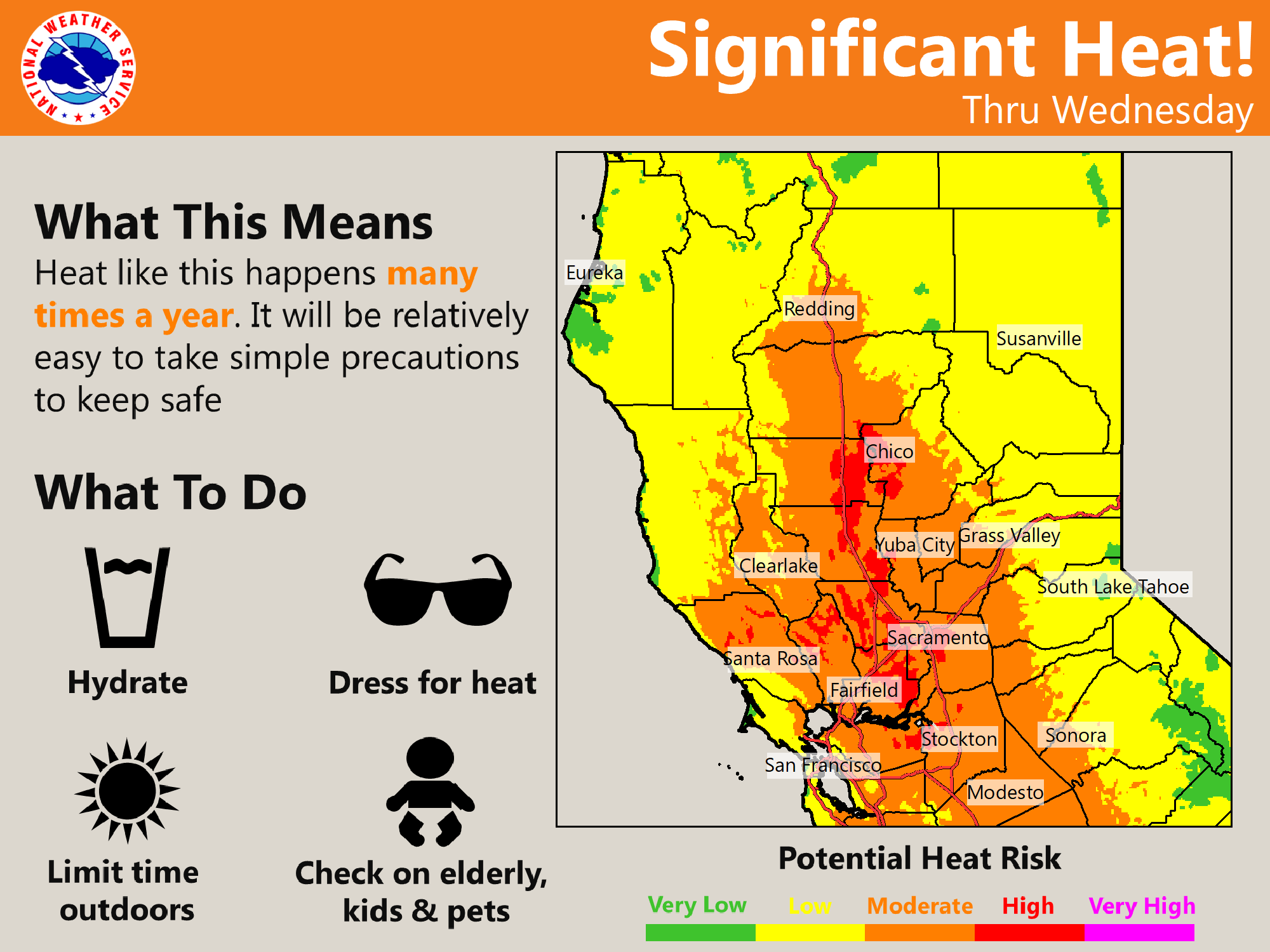
Periods of breezy north winds and low humidity will result in critical fire weather conditions through Wednesday morning. Moderate, to locally high, heat risk continues through mid-week with temperatures peaking Wednesday. Cooler weather returns later this week with possible light precipitation over Shasta County. Red Flag Warning until 11 AM PDT Wednesday, Heat Advisory from noon today to 11 PM PDT Wednesday.


Discussion
Clear skies cover interior NorCal early this morning as the upper ridge axis moves closer to the coast, and high clouds spilling over the ridge have shifted further east. Offshore surface pressure gradients have tightened a bit compared to early Monday with a few northerly gusts of 10-20 mph occurring along the western edge of the Sacramento Valley, and local northeast gusts of 20-35 mph in the northern Sierra.

Current temperatures are running milder compared to 24 hours ago and are mainly in the 60s to mid 70s across the Central Valley. Temperatures will trend up into mid-week with widespread moderate and locally high heat risk expected for the Valley today and Wednesday as highs approach record levels. Overnight lows will also be quite warm, especially tonight when Valley lows will only drop to the mid 60s to mid 70s.
A Heat Advisory remains in effect until 11 pm Wednesday for the Valley and eastern Delta. Record highs are most likely on Wednesday, the projected hottest day of the week.
Ensembles show the ridge shifting east after mid-week allowing a combination of synoptic cooling and onshore flow to bring relief to interior NorCal. By Friday, highs are expected to cool about 10-20 degrees from Wednesday.

Extended Discussion (Saturday through Tuesday)
Multiple short wave troughs progged through interior Northern California over the weekend with NBM showing a threat of showers over northern portions of the CWA. High temperatures expected to be near to slightly below normal.
High pressure builds inland early next week resulting in dry and warmer weather with some gusty north to east wind.