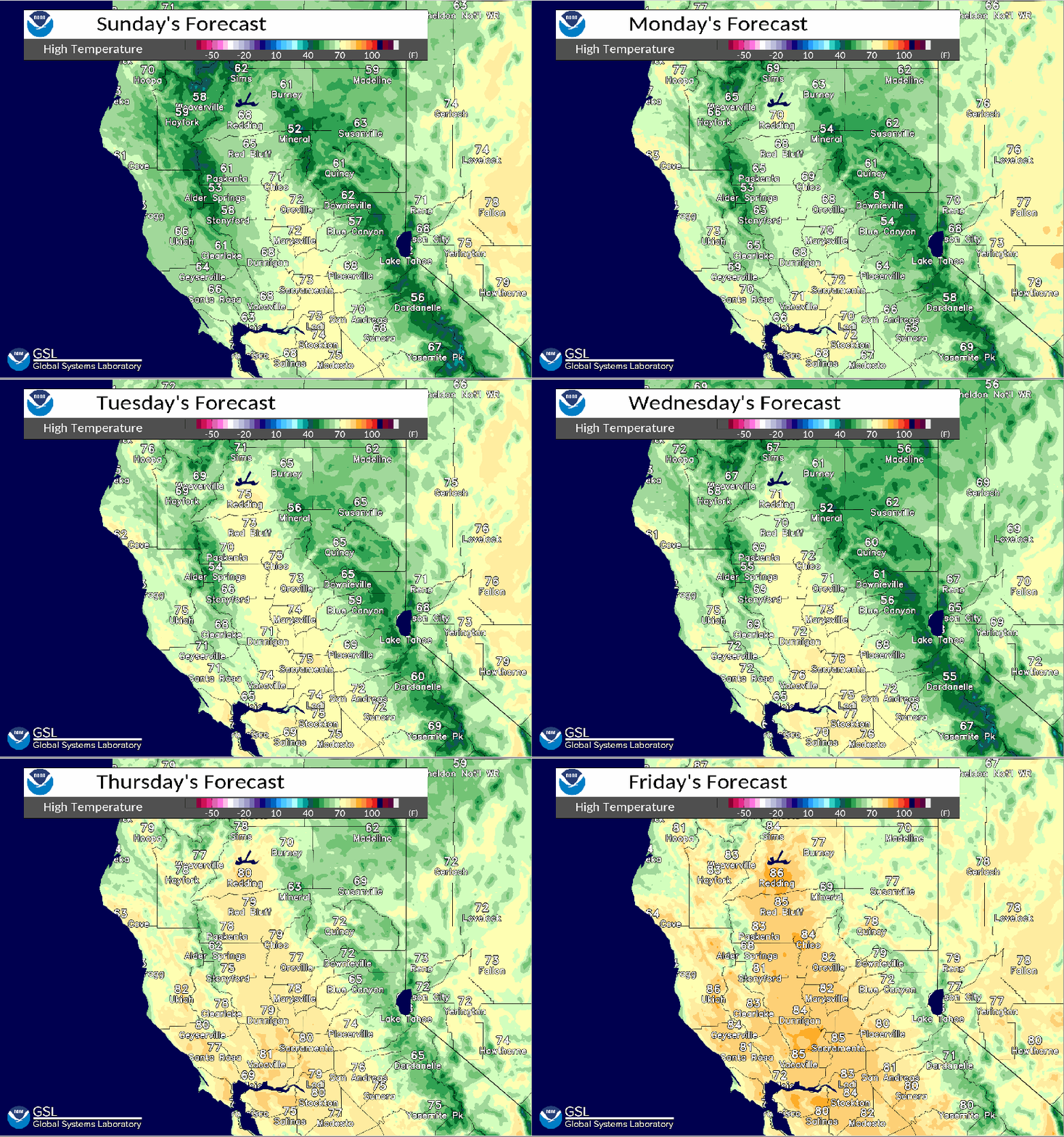
Showers and thunderstorms possible over interior Northern California through Wednesday. High temperatures well below normal through midweek, returning to near normal by next weekend.

Discussion
Large 550 DM upper low centered about 150 NM west of KUKI this morning with embedded vorticity maxima rotating around it into NorCal. Radar showing light to moderate showers over the Coastal Range attm, spreading into central and northern portions of the Sacramento Valley. Models continue to differ on eastward rate of progression of associated precip today.

With 125+ kt jet streak progged down west side of low, favor slower model solutions. High temperatures will be upwards of 15 to 25 degrees below normal today with upper 60s to lower 70s expected in the Central Valley.
Upper low progged west of the Bay Area Monday where it looks to remain quasi-stationary into Tuesday.
Jet streak intensifies along leading edge of low Monday, focused over the Coastal Range into interior NorCal.

Heaviest precip potential for the CWA looks to be the best during this period. Snow levels remain above 8500 feet. Model instability increases over the area Monday for better thunderstorm potential.
High temperatures continue well below normal Monday. Jet support weakens Tuesday, but upper low remains in place off the Central CA coast continuing scattered showers and isolated thunderstorms.
High temperatures forecast to edge up into mid 70s across the Central Valley Tuesday.

Storm total QPF through Tuesday looks to be around 0.50 to 1.50 inches in the Central Valley, 2 to 3 inches over the Coastal Range, 0.75 to 2 inches for the foothills, Shasta mountains and Sierra Nevada.
Unsettled weather continues into Wednesday as low progged to lift to the NE through NorCal. Additional amounts of precip look to be mainly light, generally around a quarter inch or less.
High temperatures Wednesday expected similar to Tuesday.
Extended Discussion (Thursday through Sunday)
Clusters in good agreement with lifting upper low northeast into Idaho Thursday with flat ridge developing behind the system over NorCal into Friday.
Ridge will gradually amplify over the weekend with a significant drying and warming trend.
