October 12, 2016 – A series of Pacific weather systems will bring periods of moderate rain (heavy over the mountains) and gusty winds late Thursday through early next week.
Discussion (Today through Saturday)
Fair weather continues today as a weak upper level ridge shifts east into the Great Basin. Partly cloudy skies should prevail across the region today as high temperatures reach the upper 70s to around 80 degrees across the Valley, and 60s to 70s over the mountains. These forecast high temperatures are a couple degrees cooler than normal for this time of year.
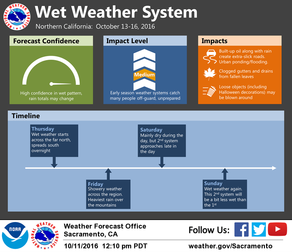
Thursday will remain dry for most of the forecast area, though the northern portions may begin to see some light precipitation in advance of a weather system. Satellite imagery already shows a Pacific basin-wide moisture plume originating from Typhoon Songda feeding into this frontal system. NAEFS ensembles show record- level Integrated Vapor Transport (IVT) values with this wave, suggesting a very strong atmospheric river event, and strong consensus amongst the models. The first wave will primarily impact the region Thursday night into Friday.
Wind and water-related impacts are the primary concerns, as snow levels will remain high. The Friday morning commute across high population centers is likely to be very slow with numerous traffic accidents. Gusty winds to 35-45 mph across portions of the Valley are likely to bring down small branches and weakened trees, causing local power outages. Winds this gusty are also likely to blow around loose objects, including Halloween decorations. Urban ponding of water on roads is likely during periods of high intensity rainfall. Clogged drains and gutters are also possible as rain and wind bring down tree leaves.
Weather becomes more showery the latter half of Friday into Saturday before the next wave arrives.
Extended discussion (Sunday through Wednesday)
Another frontal system progged into Interior NorCal Sunday as atmospheric river remains focused into the CWA. This system will bring widespread precipitation Sunday into Sunday night. Weaker waves continue across the north Monday into Tuesday keeping a threat of precipitation over the mountains and northern portions of the interior. Additional QPF amounts from Sunday through Tuesday look to be range from about 0.1 in the Northern San Joaquin Valley to around 1 inch in the Northern Sacramento Valley, and 1 to 2.5 inches in the foothills and mountains. Snow levels will generally be above 7000-7500 feet. Periods of breezy to windy conditions can be expected to accompany these systems. High temperatures will continue 10 to 20 degrees below normal over the weekend into early next week.