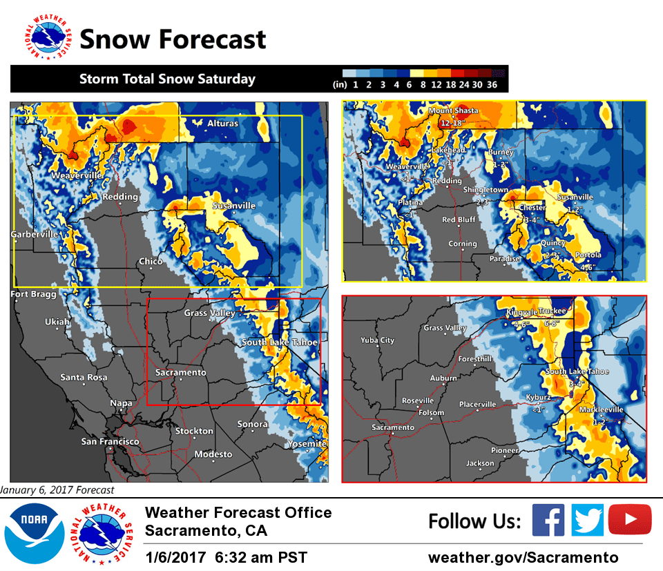
January 6, 2017 – An atmospheric river, a narrow corridor of concentrated moisture, will impact interior Northern California over the weekend. Snow begins early Saturday morning becoming moderate to heavy at times. Snow levels will initially be into the Foothills but rise during the day, climbing above pass levels Saturday afternoon into night. Snow remains above pass levels Sunday when the heaviest precipitation is forecast.
Winter weather advisory remains in effect from 4 am to 10 pm Saturday
Main Impact: Hazardous winter travel with reduced visibilities, chain controls, and traffic delays.
Timing: Snow develops early Saturday morning becoming moderate to heavy at times throughout the day. Snow levels will initially be around 2000 to 3000 feet, but rise during the day to above pass levels Saturday night and remain above 8000 feet Sunday.
Locations include Interstate 80, Highways 36, 50, 70 and 88.
Snow accumulations 5 to 10 inches above 5000 feet with up to 2 feet of new snow at the highest elevations. A couple of inches of snow possible down to 2000 feet.
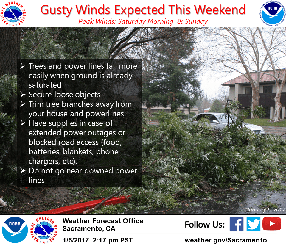
Other impacts: Wind gusts over 50 mph at times bringing periods of white out conditions