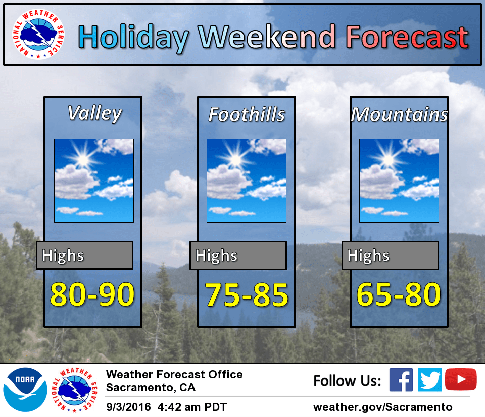
September 3, 2016 – An upper level disturbance will pass over the west this weekend, which will bring below normal temperatures and slight chances for showers in mountain portions of northeast California. The disturbance moves east starting Labor day as an upper level high pressure system brings a return of near to slightly above normal temperatures for the coming work week.
Discussion
High clouds, ahead of a weak wave moving through the base of the western trough, linger across the region this morning but will shift to the east by this afternoon. Onshore gradients have picked up a bit, and along with some synoptic cooling associated with the trough, will result in a little cooler temps across interior NorCal today. Best chance for showers will be later tonight across the northeast corner of the state as a stronger short-wave drops down from the north.
Current water vapor imagery and model forecast analysis indicated a positively tilted upper level trough positioned over the western portions of the CONUS with continued southward movement. Trough base just located off the coast was pushing moisture stream quickly to the east overnight, and upper level high clouds were beginning to clear out.
The main feature of the short term forecast period continues to be the digging trough into the forecast area through the weekend. Cooler temperatures for the holiday weekend will result with below normal values across the valley and upper elevations. Slight chances for showers to the mountains in northeast California are still possible Saturday night into Sunday morning, but short term high resolution model solutions have backed off the precipitation trend. A dry slot of air aloft seen on overnight water vapor satellite imagery may play a role in delaying the development of showers. If the current southward movement continues through the day today, showers may not develop over interior northern California and remain east of the Sierra crest and along/north of Mount Shasta. An influx of dry air will also reduce the instability aloft, so any showers should remain without lightning. Two separate trough pushes will move through the region by early Sunday morning, and any showers that potentially develop will move eastward outside of the forecast area by that time.
Temperatures will begin to warm up Labor Day as a upper level high pressure system builds in the eastern Pacific, although temperatures will remain slightly below normal for September. High temperatures are expected to return to near normal by Tuesday for the southern Sacramento and northern San Joaquin Valleys, but still slightly below normal for the northern Sacramento Valley.
Extended discussion (Wednesday through Saturday)
Flat upper level ridging will slowly build over the west coast through the extended period. This will bring generally dry conditions and daytime highs a few degrees above normal. Winds should remain generally light with limited onshore flow allowing the above normal temperatures.