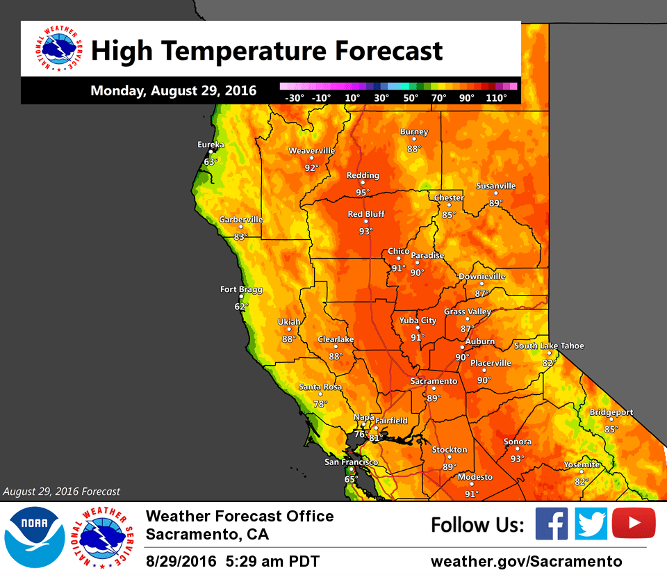
August 29, 2016 – Below normal temperatures and locally breezy this week. Mostly dry except for isolated showers over the Coast Range early Tuesday.
Discussion
High clouds, originating from Tropical Storm Madeline to the east of Hawaii, are moving into NorCal early this morning as flow aloft becomes more southwesterly ahead of the developing trough over the Gulf of Alaska. The marine layer has lowered to around 2K feet and current temperatures are running about the same as 24 hours ago.
Little change expected today compared to Sunday as weak upper ridging covers the region.
Models are coming into better agreement brushing a short-wave across far northern California early Tuesday. Moisture is progged to be pretty limited, but a few light showers will be possible Tuesday morning across the Coast Range and far northern mountains before the feature lifts up into Oregon.
Trough settles in just off the coast for the remainder of the week resulting in occasionally breezy conditions for interior NorCal along with temperatures a little below average.
Extended discussion (Friday through Monday)
Northern California will remain under a longwave trough pattern through the extended period, bringing cooler than normal temperatures for next week. Any precipitation looks to remain to our north and east. By next weekend, the trough axis may shift just east of area and bring northwest flow aloft and some drying, northerly boundary layer winds.