June 12, 2017 – Unseasonably cool weather system exits the region today. Drier weather with a warming trend expected the remainder of the week.
Discussion
Upper low is shifting east into the Great Basin. Wrap-around showers continue on the backside of the low across the northern Sierra Nevada where light snow is currently being reported at KBLU and KTRK. Current temperatures are running around 4-8 degrees cooler across most of the region compared to 24 hours ago and generally range from the upper 20s and 30s in the mountains to the 40s to mid 50s elsewhere.
Temperatures will be a little milder today as the low moves further east and subsidence begins to increase in its wake across interior NorCal. The shower threat will linger into midday over the northern Sierra, but additional snowfall accumulations are expected to be light and limited to the crest.
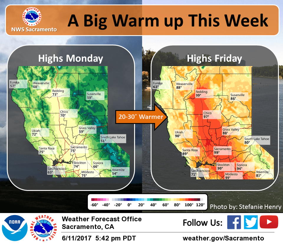
Broad upper ridging shifts over the region Tuesday-Thursday with dry weather and continued warming. Temperatures are expected to return to slightly above average by Thursday.
Extended discussion (Friday through Monday)
Broad upper ridging over the West Coast amplifies through the extended forecast period resulting in dry weather with increasing heat. High temperatures go from 10 to 15 degrees above normal on Friday to upwards of 20 degrees of more by Monday.
With current guidance, potential for near record values Monday in portions of the Central Valley as highs climb to around 105 degrees. This may also warrant issuance of heat advisories or warnings.
Models move trapped upper low towards the area early next week. However current runs keep it far enough away to not draw moisture up along the Sierra Nevada, which could result in afternoon showers or thunderstorms.