
MARYSVILLE – Caltrans is alerting motorists about the next round of winter weather to impact travel across Northern California starting mid-week. This storm is expected to be colder and more impactful with lower snow levels compared to previous storms this season.
The National Weather Service (NWS) has issued a Winter Storm Warning from 10 p.m. Tuesday through 4 a.m. Friday for accumulation between 12 and 36 inches of snow above 5,000 feet and snow rates of up to 2 inches per hour at times. A dusting of snow is also possible as low as 3,500 feet.
Motorists are encouraged to avoid travelling through the Sierra Nevada if possible. If motorists must travel during expected storm hours, they should be prepared for chain controls, road closures, additional travel times and delays.
Additional precautions include:
- Ensure vehicles have a full tank of gas or full charge
- Carry chains and extra supplies in the event of an emergency or if traffic is held for an extended period. Supplies include but are not limited to: extra snacks, water, blanket and flashlight.
- Give snowplows room to work. Stay at least four car lengths behind snowplows and snow removal equipment and do not pass them.
- Stay on the highway and do not use GPS to avoid or bypass chain control. Local roads are often plowed less frequently and can be in worse shape, leading motorists to become stranded and stretch emergency services thin.
In addition, the forecast calls for 1 to 1.5 inches of rain in the Sacramento Valley and Sacramento-San Joaquin Delta, and up to 3 inches of rain in the foothills. The NWS has issued a Wind Advisory for the valley from 10 p.m. Tuesday through 4 p.m. Wednesday with sustained winds of 20 to 30 mph and gusts up to 50 mph.
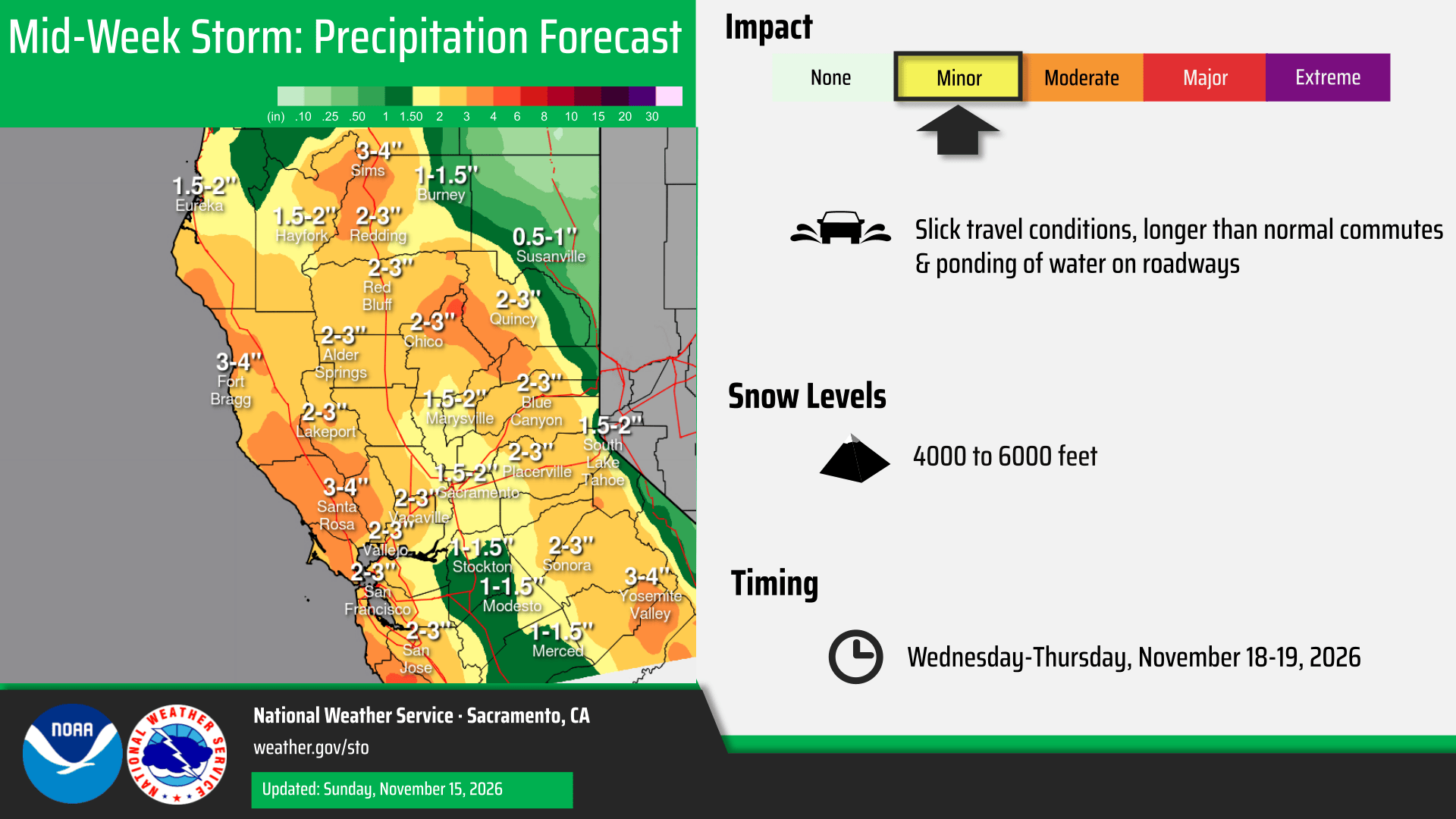
Motorists traveling in the valley should be prepared for wet weather, additional travel times and delays. Caltrans advises that vehicles have properly functioning headlights and windshield wipers and not to drive through flooded roads.

For additional information, motorists are encouraged to check the NWS forecast for updates, and the Caltrans’ QuickMap website for current road conditions and chain requirements. QuickMap is also available as an app from the App Store or Google Play. Road information is also available on the Caltrans website or by calling the California Highway Information Network automated phone service at 1-800-427-ROAD (7623).