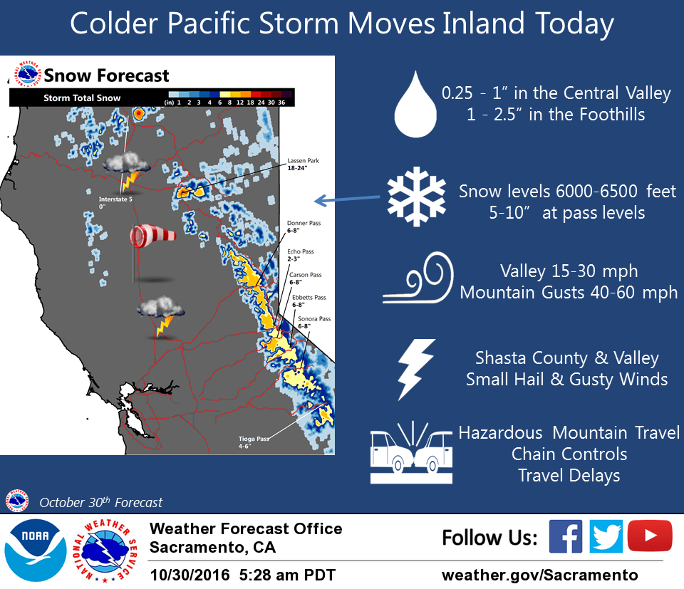
October 30, 2016 – Wet unsettled weather continues into Tuesday as several weather systems move across the area. Heavy snow will be possible at Sierra pass levels today into tonight with lighter amounts possible later Monday into Tuesday. Winter Storm Warning from 10 AM this morning to 11 PM PDT this evening for West Slope Northern Sierra Nevada.
Discussion
Moisture fetch aimed over the Northern Sierra Nevada this morning is producing area of orographically induced showers from the Motherlode into the West Slopes. Meanwhile main upper low is moving inside of 130W with associated precip band slowly moving onshore. Models have trended slower with onset of main precip and thus have adjusted timing for WSW. QPF also looks lower than previous runs too so have lowered snow amounts. Bulk of higher elevation snow…above 6000 to 6500 feet…expected this afternoon into early evening. Snow amounts of 5 to 10 inches possible at pass levels.
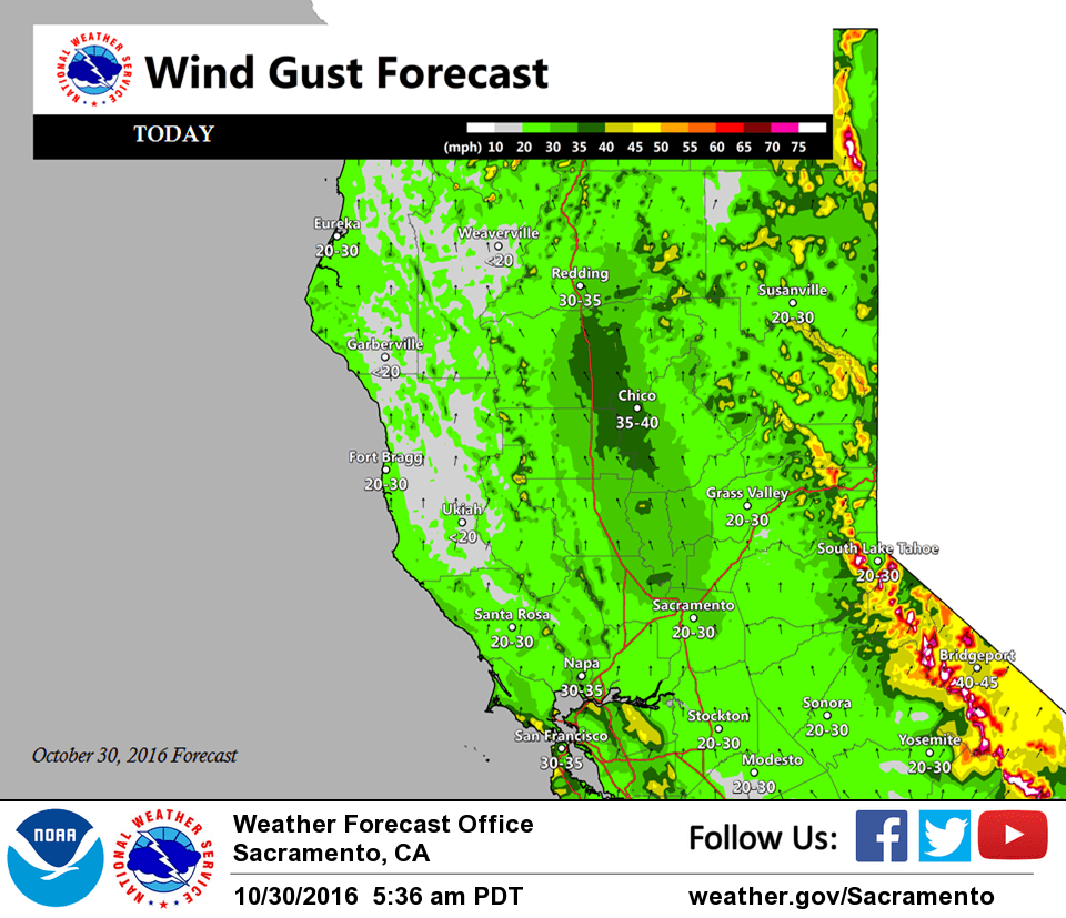
Winds will also increase this morning becoming breezy to windy over Interior NorCal midday into the afternoon. Wind MOS guidance continues to differ significantly between NAM and GFS with stronger GFS showing only a few spots in the Central/Southern Sac Valley briefly reaching advisory criteria midday into early afternoon. So will maintain current wind forecast values which are near but slightly below criteria. Gusty winds expected in the mountains this afternoon and combined with heavy snow over higher terrain will impact travel. Best CAPE advertised from Shasta to Sacramento county and points eastward into the foothills this afternoon for isolated thunderstorm potential.
Precip turns showery this evening and decreases overnight as short wave tracks east of the CWA. Another Pacific upper low follows inland Monday into Monday night spreading additional precipitation into Interior NorCal. Models suggest a wet Halloween for most areas. Precipitation amounts look less than the system moving through today but with colder air already in place higher elevation mountain snow may continue and pose impacts to travel over passes.
This wave shifts east into the Great Basin Tuesday with lingering mountain showers possible. Upper ridging then builds over NorCal midweek providing drier weather with minor warming.
Extended discussion (Thursday through Sunday)
Extended period starts out with Norcal under upper level southwest flow between high pressure over the western U.S. and low pressure trough over the Eastern Pacific. A shortwave trough moving through the southwest flow is forecast by multiple extended models to clip the northwest corner of the state early Thursday for some possible coast range light showers.
Otherwise Thursday looks dry CWA wide with daytime highs just a bit below normal for early November. Temperatures warm just a bit on Friday to right around normal and Friday should be another dry day. Model consistency decreases by next Saturday as models diverge. GFS brings a frontal band into Norcal during the day on Saturday while the ECMWF holds off on this feature until Sunday. GEM model may be even slower.
Have taken a middle of the road approach for now with precip over far norcal Saturday night but confidence is definitely not high. Sunday looks dry again with below normal highs but model differences continue.