February 4, 2020 – Breezy northerly winds will persist into today. Cold morning lows through Wednesday morning. Dry conditions expected throughout the rest of the week, with just light Sierra showers Sunday.
Discussion
The region remains between eastern Pacific ridging and a trough over the Great Basin. Skies are clear and humidity levels are low, good radiative cooling conditions. Some breezy northerly winds continue this morning, though.
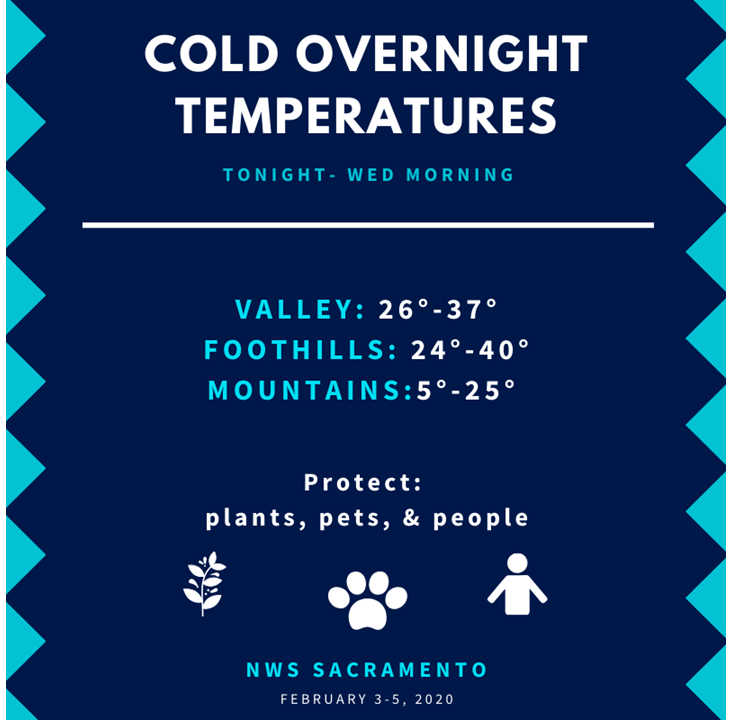
Current temperatures (3 am) this morning are very dependent on the wind, with wind sheltered areas cooler than yesterday and unsheltered areas generally warmer. Examples of this are Fairfield, which at 43 degrees is 11 degrees warmer than the same time yesterday, with a north (downslope) wind of 15 mph, with gusts to 23 mph. Modesto, on the other hand at 33 degrees is 7 degrees cooler with west winds at 5 mph. A Freeze Warning remains in effect through 9 am this morning for the more sheltered areas such as extreme Southern Sacramento Valley, extreme southeast portion of the Delta and the Northern San Joaquin Valley Counties. Temperatures there are on track to drop below freezing. Dewpoints are quite low, which will make this a freeze event more than a frost event. The higher Sierra have some spots already down into the single digits, such as the Tahoe Donner RAWS at 9 degrees, 5 at Independence Creek.

North winds will not be quite a strong as yesterday but will be breezy with afternoon gusts to 25-30 mph. Lighter winds are expected beginning tonight.
High temperatures this afternoon will be similar to yesterday in the Valley, mid 50s. The mountains will increase by about 10 degrees, though, as ridging brings warmer temperatures aloft. Wednesday will be noticeably milder across the area, with Valley/Delta/foothill highs in the upper 50s to mid 60s. Thursday and Friday should be even warmer, with the warm spot Redding reaching around 70 degrees.
Extended Discussion (Saturday through Tuesday)
High pressure will give way to a trough digging over the intercontinental west. Guidance continues to show the trough sliding CA/NV area before dropping in SoCal. Expect most areas to remain dry with this system with the exception being some light snow showers over the Sierra. Strengthening gradients will support another round of breezy northerly winds Sunday into Monday. Latest NBM and ECMWF ensemble suggests wind gusts in the 20 to 30 mph range in the Valley, with higher gusts over the mountains.