September 6, 2017 – Cool down continues this week into Thursday. Shower and thunderstorm chances for the next several days, especially over the mountains. Temperatures warming back up for the weekend.
Morning Update (8:27 AM PDT)
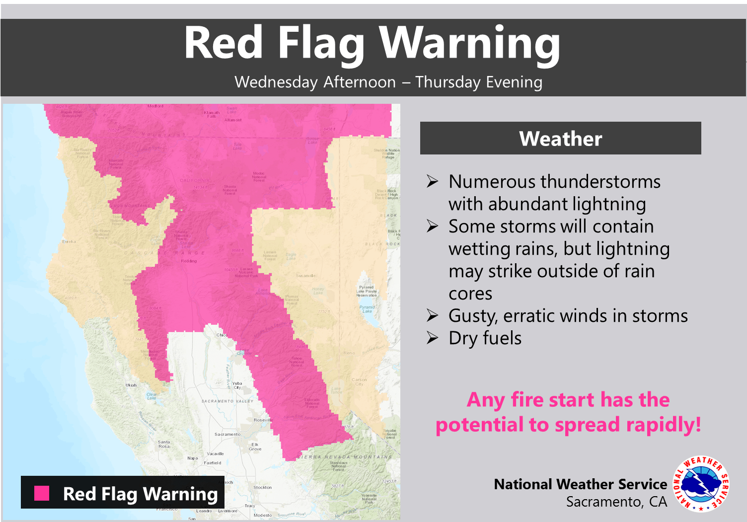
Upgraded the fire weather watch for the mountains, foothills, and northern Sacramento Valley to a red flag warning for abundant lightning. Latest short term high resolution model guidance suggests storm initiation over the mountains around 2 pm this afternoon and spreading northward across the northern Sierra and foothills. Some storms may drift into the northern Sacramento valley tonight.
Discussion
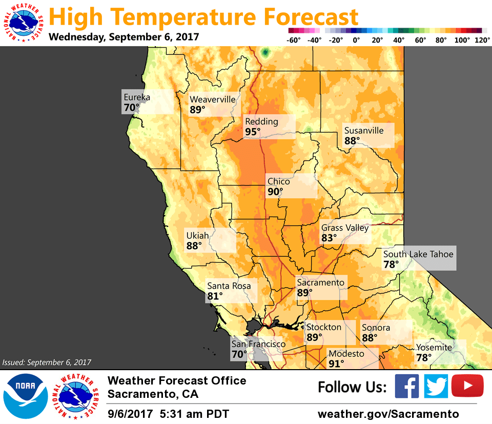
Moisture continues to stream up from the southeast with a few light showers currently over the northern portion of the forecast area while a few thunderstorms are present to the east of Mt Lassen. Current temperatures are pretty similar to readings from 24 hours ago ranging from the upper 40s in the mountain valleys to the mid 70s across milder portions of the Central Valley.
Another active day of mountain thunderstorms is expected as the pattern remains relatively unchanged compared to Tuesday. The closed low off the coast is forecast to move closer to the Bay Area by this evening, then lift northward across NorCal tonight and Thursday as the upstream trough approaches.
This feature will likely act on the deep moisture and elevated instability that lies across the region resulting in an increase in showers and thunderstorms tonight into Thursday as it tracks north. A fire weather watch has been issued for the potential for abundant lightning.
Trough lingers Friday with mountain shower and thunderstorm chances continuing. It is then forecast to close off along the central California coast by the weekend with warmer and drier weather forecast to return.
Extended discussion (Sunday through Wednesday)
A closed upper low will float around off the California coast early next week. At this stage, it appears the low will initially be close enough to draw monsoon moisture north along the Sierra, but far enough that thunderstorm coverage should be isolated. Temperatures across the region will likely be a bit warmer than normal during this timeframe.
Toward the middle of next week, this system is projected to finally push inland over California. There could be potential for scattered thunderstorms as it does so, though confidence isn’t particularly high at this stage. We should begin to see another cooling trend as this system pushes inland.