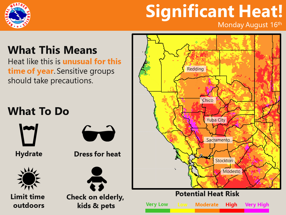
After another hot day Monday, more seasonable temperatures are expected by Tuesday through next weekend. Breezy and dry conditions are forecast with elevated fire weather concerns early to mid week. Area wildfires will continue to produce smoke that will impact nearby locations.
Discussion
2:00 am satellite imagery indicates plenty of smoke moving northeast over the western part of Shasta County from the Mc Farland fire this morning. Satellite derived fire temperature shows some decreased activity from earlier on Sunday evening. Nearby areas will likely see hazy and smokey skies as the sun rises over the region this morning. Temperatures are mild with many locations still in the 70s and 80s as of 2:00 am.
Hot temperatures will linger today. However, highs are expected to be several degrees cooler in the Northern Sacramento Valley as compared to yesterday. 850 mb temps are forecast to decrease several degrees over Northern California today. However, highs in the Valley south of Chico could be warmer today as compared to yesterday. Smoke from area wildfires reduced solar heating at the surface and kept temperatures down slightly on Sunday. More clearing of smoke from areas wildfires is expected today as onshore flow increases. This will likely allow more solar heating to reach the surface and possibly lead to warmer temperatures today.
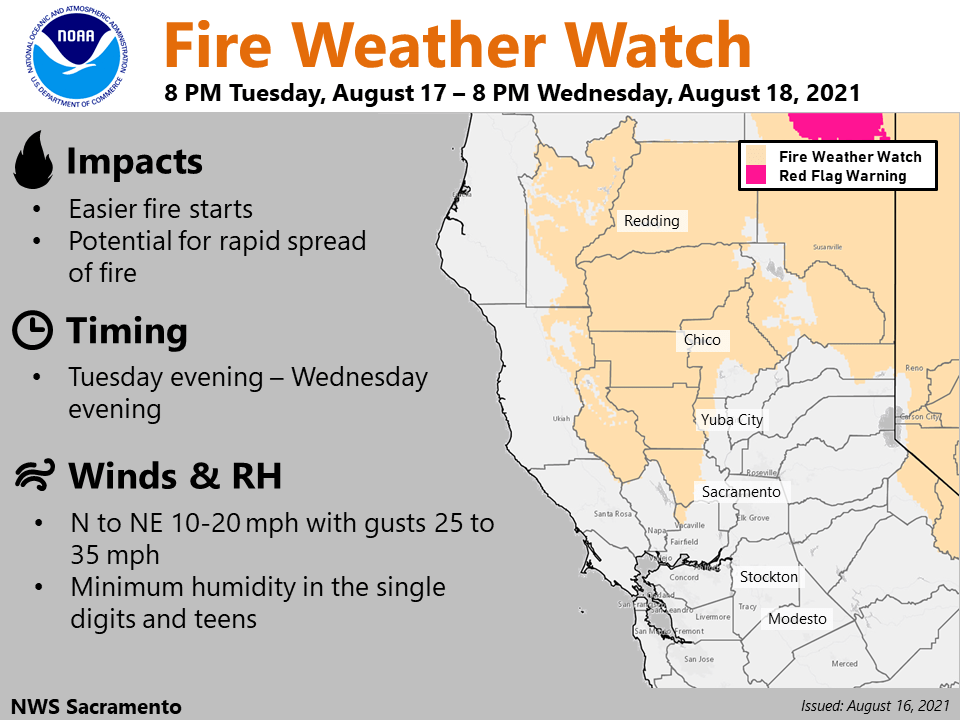
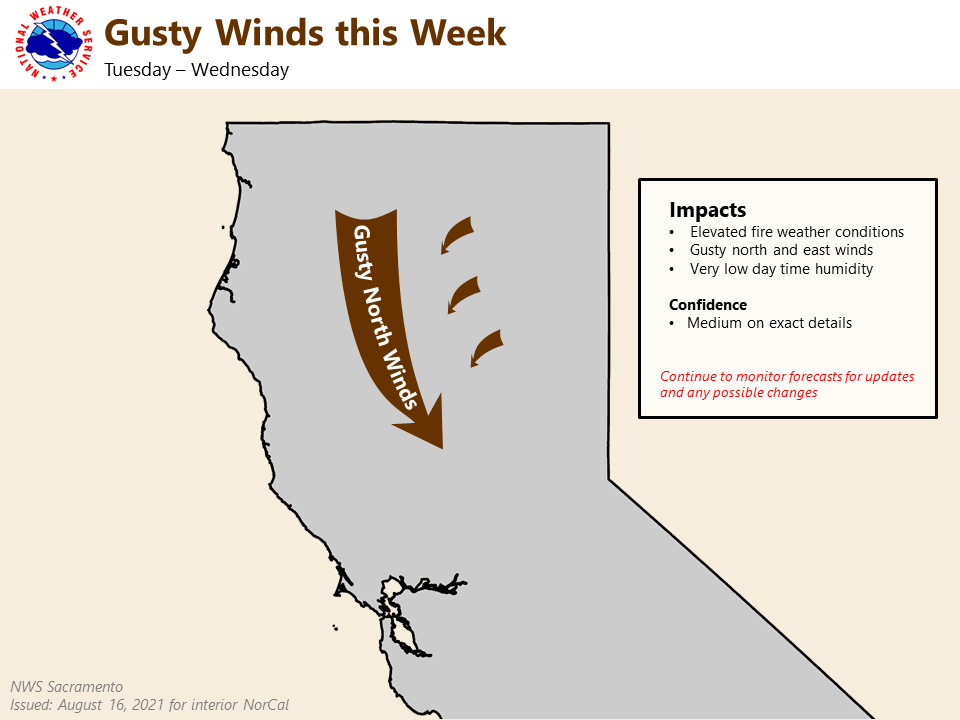
Changes are on the horizon as a low pressure system drops into the great basin early to mid week. Cluster analysis is in good agreement about this pattern change. This synoptic pattern could bring breezy and dry northerly to northeasterly winds to Northern California Tuesday into Wednesday. Smoke from regional fires could also be transported to surrounding areas as well as into the Valley.
Fire Weather
A period of gusty west to northwest winds is expected again later today into this evening along the western edge of the Sacramento Valley (affecting the McFarland Fire) as a strong surface pressure gradient tightens between the coast and the thermal trough centered over the Sacramento Valley.
A longer duration north to northeast wind event is possible Tuesday night and Wednesday primarily affecting the western and northern portions of the Sacramento Valley and surrounding foothill and mountain terrain. This is expected to be a moderately strong event as the MFR-SAC surface pressure gradient increases to around 12 mbs resulting in gusts of 25-35 mph along the western edge of the Sacramento Valley.
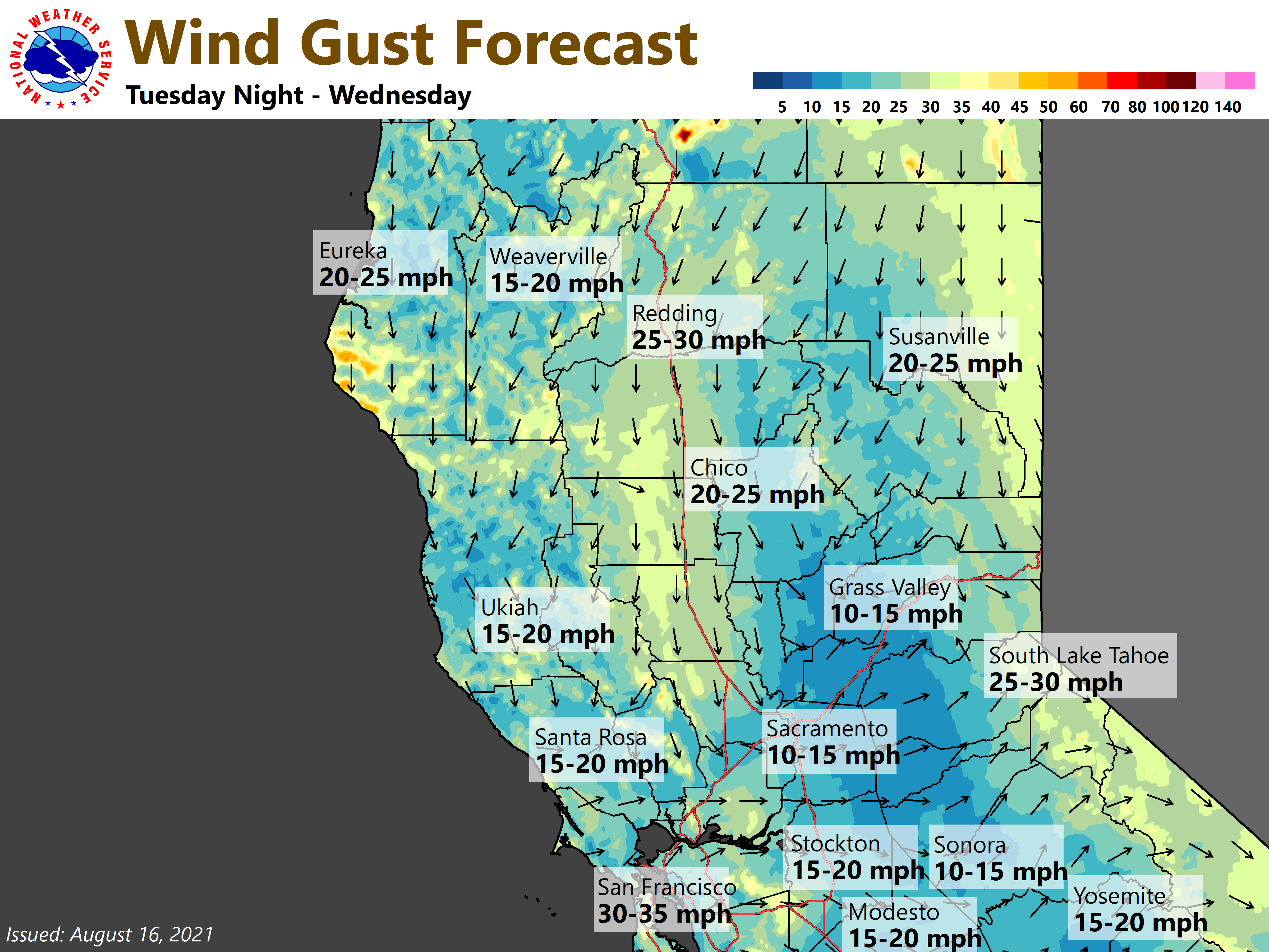
Locally higher gusts will be possible across favorably oriented canyons over the foothills and mountains of the eastern portions of Shasta, Tehama and Butte Counties. The gusty wind combined with low humidity and extremely dry fuels will result in possible critical fire weather conditions, and a fire weather watch has been posted.
Extended Discussion (Friday through Monday)
Cluster analysis portrays the Eastern Pacific high edging into California late this week. Large discrepancies start to emerge towards next weekend in regards to the strength of the ridge. Ensemble guidance is picking up on another possible low pressure system passing just to our north and east. Depending on how far this trough extends southward, we could see some dry and breezy conditions develop. However, there is not a clear signal for anything all that impactful at this time.