Unsettled weather continues through Friday bringing cooler temperatures, scattered showers, and breezy winds at times. The most precipitation is expected Friday, with light high elevation mountain snow. Dry and breezy north winds are forecast through the Valley early next week which will lead to the potential for increased fire weather concerns.

Discussion
A few light returns are noted on radar early this morning, although most precipitation seems to be falling as virga or just some traces. Increased cloudiness is expected today as the main trough advances towards California with generally only light showers expected over the northern Sierra/southern Cascades through the afternoon.
The better chances for precipitation will be late Thursday night into Friday as the trough moves inland, with the heaviest precipitation over the Sierra Nevada south of I-80 and Motherlode region. QPF amounts have stayed relatively similar to the previous forecast with anywhere from 0.25-0.65″ expected in these areas.
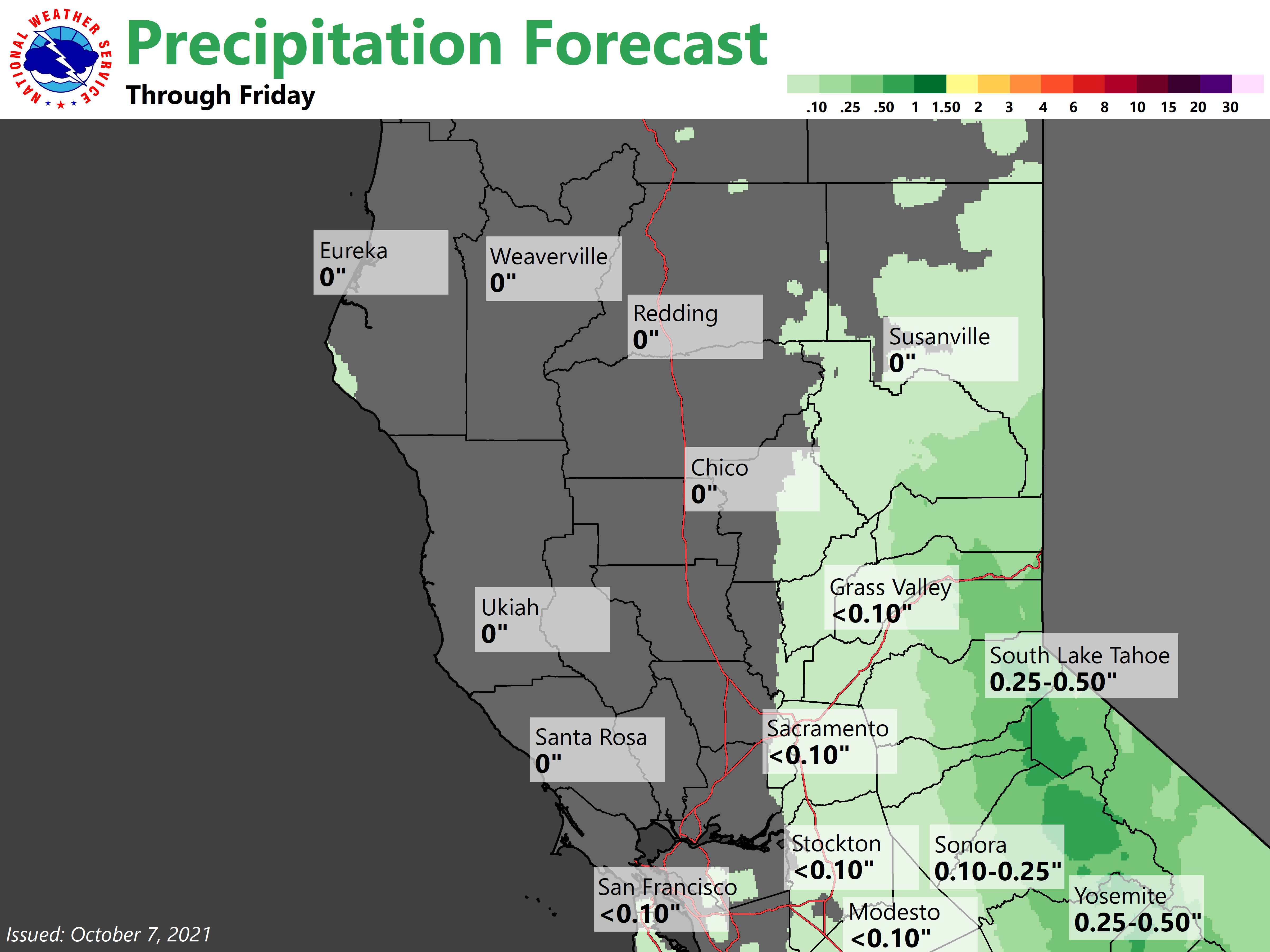

Unfortunately, most of the Valley will either remain dry or only see a few hundredths of an inch of precip. Over 7-7.5 kft, some snow showers will also be possible, with some light accumulations up to around 3 inches, locally higher on the highest peaks. This system exits the area Saturday with ridging briefly moving back over California for the weekend.
As for temperatures, afternoon highs will be around 5 to 8 degrees cooler this afternoon than those of yesterday. Expect the coolest day of the week to be seen on Friday with Valley highs topping out in the mid to upper 60s.
With the aforementioned ridging returning for the weekend, temperatures increase slightly Saturday and again on Sunday (but still remain slightly below average for early to mid October). Any snow that does fall in the high elevations would not last long due to these rising daytime highs.
Extended Discussion (Monday through Thursday)

Ridging breaks down again Sunday night as another trough begins to move over the PacNW into the Central Great Basin Monday and Tuesday.
While clusters show some uncertainty in the depth of this trough, confidence continues to increase that significant north winds will bring elevated fire weather concerns to much of the area, with an emphasis the western portion of the Sacramento Valley.
Gusts from 25 to 35 mph look possible at this point, but continue to keep up to date with the forecast. A few mountain showers will also be possible with this system.