May 3, 2021 – Warm and dry weather pattern will continue through mid week, then cooler late in the week. Gusty northerly winds likely today resulting in fire weather concerns.

Discussion
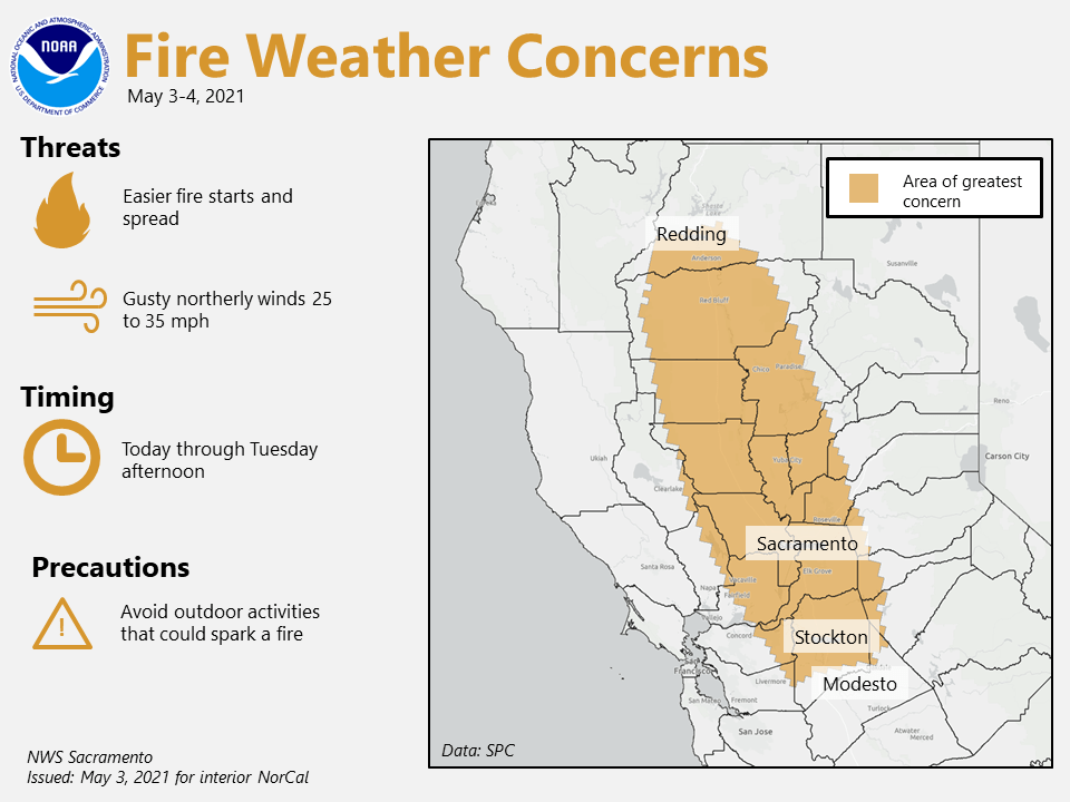
Upper level ridge in place over NorCal is bringing dry and very warm conditions. Surface high pressure associated with the ridge over the Eastern pacific is causing a tight surface gradient and resulting gusty north winds down the Sacramento Valley.

Gusty winds will continue today with a few gusts to 35 mph. These winds combined with low humidity, will result in critical fire weather conditions. Strongest winds are forecast along the west side of the Sacramento Valley.

Gradient should begin to diminish Tuesday with wind gusts more in the 15 to 20 mph, although still could be some enhanced fire weather concerns mainly over the Northern/Western Sacramento Valley with the very dry conditions.
High temperatures in the upper 80’s today over Valley locations will warm further into the low and mid 90’s Tuesday and Wednesday. Record highs generally range from 95 to 100 degrees at most locations during these day, so could approach records at a few locations, if temp trends warm a bit.
Ensembles and clusters in good agreement with trough approaching the West Coast Thursday. This will likely initiate onshore flow/Delta breeze, which will cool temperatures back into the upper 70’s and low 80’s.
Extended discussion (Friday through Monday)
Models trending drier with the short wave trough moving through Friday. Main impact appears to be some cooling and locally gusty wind.
Deterministic models beyond Friday with EC digging upper lows farther west over NorCal. GFS and ensemble solutions support more progressive waves with NorCal remaining sandwiched between EPAC upper ridge and upper low in the Intermountain West.
Forecast remains dry over the weekend into Monday with some gusty north to east wind, and above normal daytime temperatures.