August 31, 2016 – Dry weather with below average temperatures this week. Locally breezy at times, mainly in the Delta and over ridgetops.
Discussion
Temperatures are running a few degrees warmer early this morning compared to 24 hours ago, as high cloudiness associated with a weak disturbance moved across the area overnight. Marine layer is very shallow this morning on the Ft. Ord profiler, and thus no stratus intrusion is expected.
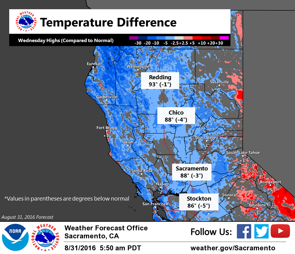
The primary weather feature this week is an upper-level trough of low pressure along the West Coast, as indicated by water vapor satellite imagery. Main impacts from this system will be synoptic cooling, as well as locally breezy winds near the Delta- influenced area and over mountain ridgetops. Dry weather is expected across our area, as models keep precipitation well to the north. Upper level trough is progged to shift inland Thursday into Friday. High temperatures are expected to be near to below normal during this period. Valley temperatures should remain in the 80s to low 90s the rest of the week, with 60s-70s for the foothills and mountains.
Extended discussion (Sunday through Wednesday)
Longwave trough axis begins to shift east Sunday. However the surface high pressure moving into Oregon will not be strong enough to cut off the onshore gradient in the Delta region. Another shortwave trough will dig into NorCal Tuesday keeping the offshore winds battling the onshore winds. Any precipitation is expected to remain north of the state. Temperatures will creep up in the extended, but still remain near to just above normal.
If the weather is “Meh,” then Meh is AWESOME! Keep on with the Meh!