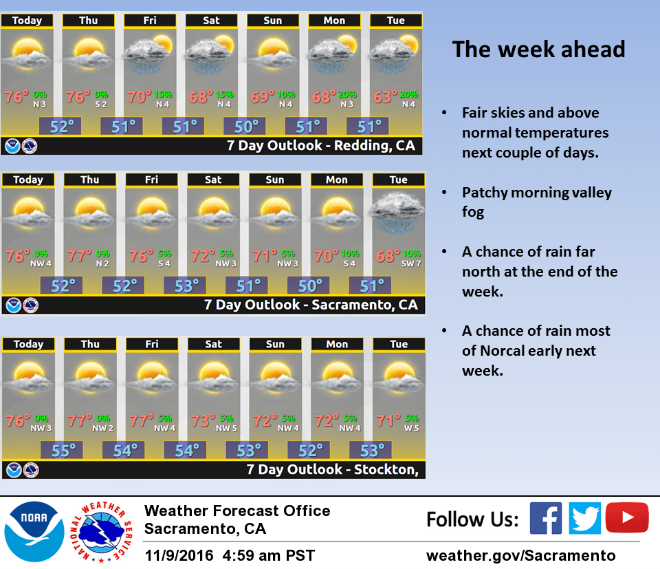
November 9, 2016 – Dry with above normal temperatures through Friday. A chance of rain coast range and northern CWA Friday night and Saturday with near normal temperatures. Dry Sunday with a much better chance of rain early to mid part of next week most of forecast area with below normal temperatures.
Discussion
High pressure over the western U.S. continues to bring dry conditions to Norcal. A weak shortwave trough moving into the Pacific Northwest is bringing some high cloudiness to the far north state this morning. Farther south, patchy valley fog has formed again in the Sacramento area, delta and northern San Joaquin valleys. The upper ridge will shift slowly eastward over the next few days as a low pressure system digs into the eastern Pacific.
A slow cooling trend is expected through Friday but daytime highs are still forecast to come in a little above normal by the end of the work week. A weak frontal band is forecast to move into the Pacific Northwest and Norcal Friday night bringing a chance of light rain to the coast range. Models in fairly good agreement in lifting this system mainly north of the forecast area so precipitation chances will be limited to mainly north of about Red Bluff. The remainder of the forecast area will see increased cloud cover and slightly cooler temperatures Saturday.
Extended discussion (Sunday through Wednesday)
Upper level ridging will bring mild and dry weather Sunday, with just some increasing high clouds over the far north as a system approaches. A weak system riding over the ridge will bring the potential for some light precipitation over the northern mountains on Monday. Dry weather is expected elsewhere.
A more substantial trough approaches Tuesday, with a shortwave bringing more widespread precipitation over the area. Both of the latest European and GFS models currently have the main cold trough moving inland Tuesday night through Wednesday. In contrast to previous systems, snow levels are expected to drop to below pass levels. Timing is uncertain this far out, but this system will be watched closely for potential winter weather impacts over coming days.