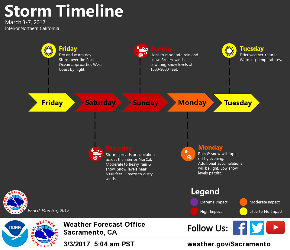
March 3, 2017 – Dry weather today then cooler unsettled weather over the weekend into Monday. Drier weather returns Tuesday.
Discussion
Interior NorCal will enjoy one more day of dry, warm weather today. Valley highs will range in the low 60s around Redding and Red Bluff, the mid 60s around Sacramento Metro region, and the mid to upper 60s for the Stockton-Modesto vicinity. Across higher terrain, daytime highs will be in the mid 40s to 50s.
On Saturday, we transition into a cooler, wetter pattern as a storm over the Eastern Pacific moves into the West Coast. Precipitation should spread across our entire CWA during the afternoon hours. Snow levels will start off around 5000 feet on Saturday, then lower significantly on Sunday. Expect snow levels across Shasta County to drop around 1500 feet impacting the Interstate 5 corridor.

Across the Sierra, snow levels will range 2500 to 3000 feet and impact mountain travel. Snow levels remain low into Monday as precipitation continues in our region. In addition to mountain snow, gusty winds along the higher elevations could cause white out conditions this weekend. Motorists should realize that if they go up to the mountains on Friday when weather is clear, then the ride home on Sunday or Monday will be impacted by snow and wind.
Winter Storm Watch still in effect for elevations of 3000 feet and higher. Light snow accumulations will occur between 1500 to 3000 feet. Snow totals around 3000 feet should range 4 to 10 inches with up to 3 feet of snow near the passes.
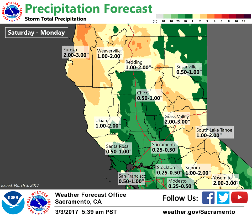
Heaviest snow will occur on Saturday. Rain totals in the valley will range around 0.40″ to a little over an inch. Precipitation will begin to taper off late Monday into Tuesday.
Extended discussion (Tuesday through Friday)
Extended models now in fairly good agreement showing flat ridge over the west coast next Tuesday. A short wave trough moving through the Pacific Northwest and NorCal, also modeled fairly consistently by models, will bring a threat of showers north of about Interstate 80.
Moderate snow levels and limited moisture will mean this will be a fairly unimpactful system. Upper ridge will continue to amplify over the west coast on Wednesday but not before one last shortwave rides over the ridge bringing a slight threat of showers over the coast range and northern mountains.
Upper ridge may build enough by Thursday to push precipitation threat north of the forecast area but models differ on this idea. For now, have kept Thursday and Friday dry but subsequent models may sag the precipitation line southward. Still looking for a warming trend through the extended period with daytime highs near normal Tuesday climbing to several degrees above normal by Friday.