Dry and warmer weather this week. Locally gusty north to east winds over the higher terrain will be decreasing this morning. Breezy offshore winds may return on Thursday.
Discussion
The eastern Pacific ridge axis will be moving eastward across NorCal and into NV today decreasing northerly and easterly pressure gradients, hence the katabatic wind. Light winds expected in the Valley today, perhaps turning weakly onshore but with little cooling effect as the marine layer has been well mixed out.

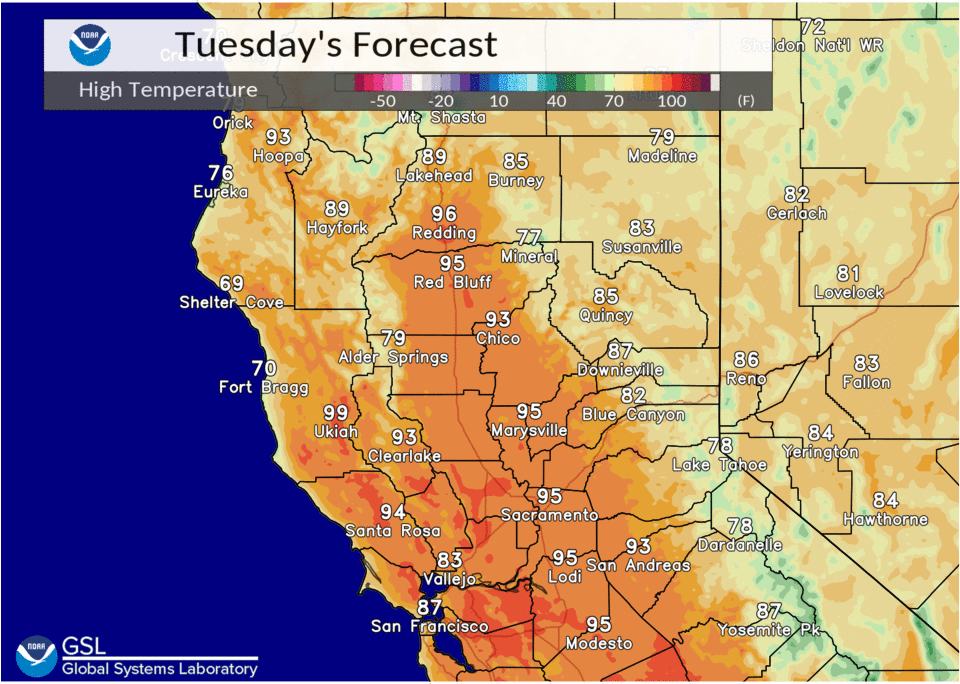
Anomalously warm air over NorCal mostly at the 700-500 mbs levels will sustain above normal max temps this week. Highs today will be some 4 to 8 degrees above normal in the Valley and lower foothills and double digit above normal temps in the Solano Co area due to the lack of a cooling sea breeze.
You may notice concentrations of smoke from the Sequoia NF and Kern Co wildfires spreading northward into/over our CWA today and then northeastward tonight as winds transition from northerly to southerly and then southwesterly. We expect the smoke to be high-based and thin.
A dry short wave trof and cold front is forecast to move through Norcal Wed. This will increase onshore flow and bring slightly cooler temps to the area, mostly 4-5 degrees or so based on slight cooling at 850 mbs and thickness values. The progressive short wave trof and cold front should push the smoke eastward on Wednesday with decreasing concentrations over our CWA during the day.
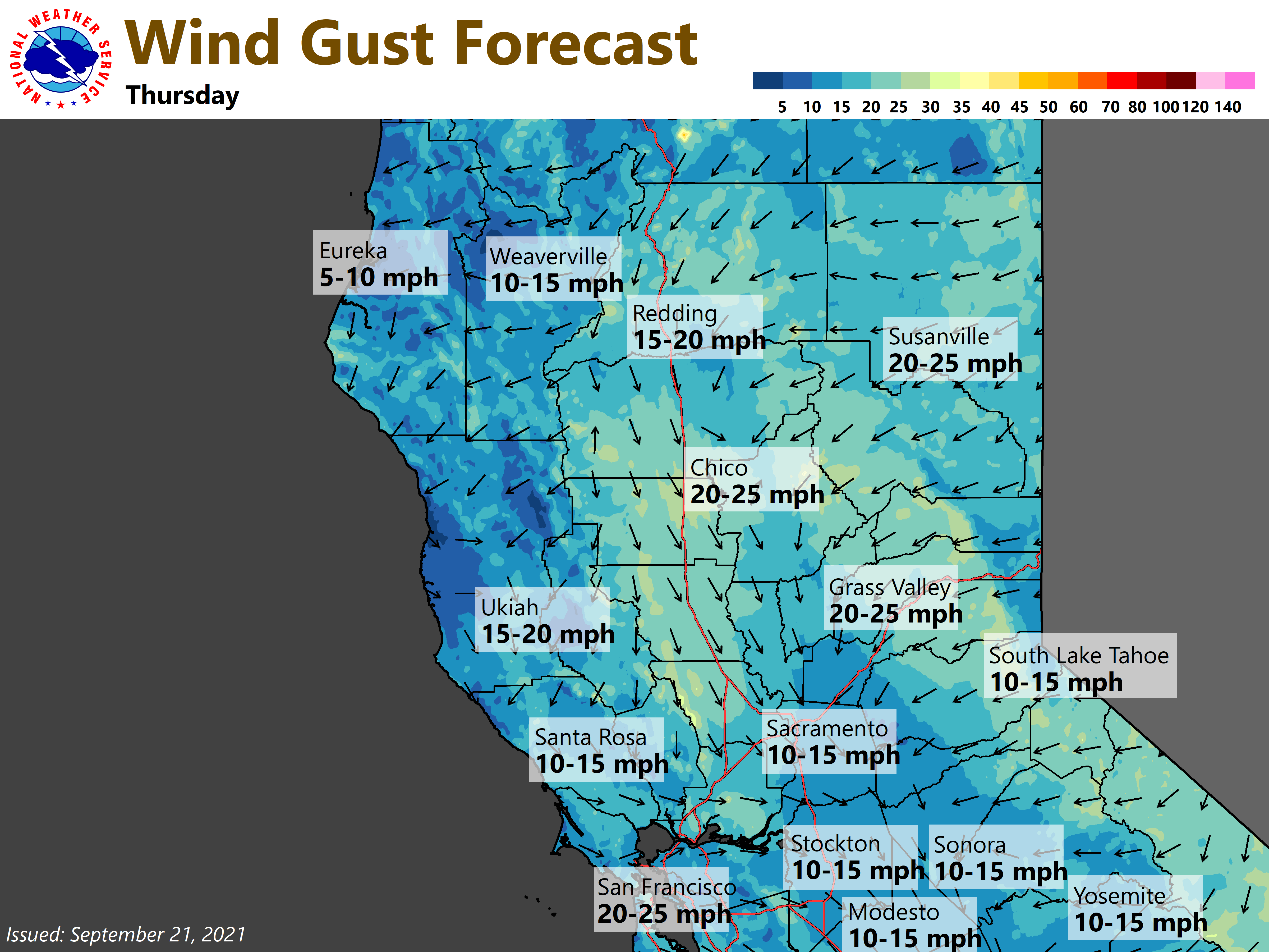
As the trof moves into the Great Basin it is forecast to retrograde, and form a closed low over the Desert SW/SOCAL/northerly Baja region and a Rex Block late in the week and weekend. While convection is likely in that area, NorCal will be on the dry anticyclonic side of the pattern with an uptick in max temps for the latter half of the work week (mostly 5-10 degrees but locally greater in the Solano Co area for Thu and Fri). In addition, the building anticyclone from the Ern Pac into NorCal late Wed night/Thu morning may bring our CWA another round of dry northerly winds, and then Ely winds Thu night/Fri morning over the W Slope Sierra mountains and foothills. This could potentially renew fire weather concerns.
Extended Discussion (Saturday through Tuesday)
Closed upper low now forecast to remain well south of the CWA over the weekend into Monday as it slowly drifts through SoCal into the Desert SW. Main impact for our forecast area will be a downward trend in high temperatures becoming near normal by Monday.
Another Pacific frontal system approaches the CWA Tuesday, bringing additional cooling, increased onshore flow, and some associated cloudiness.