September 22, 2016 – A slight chance of showers or thunderstorms across the northern mountains and Sierra today then dry through the middle of next week. Breezy north winds through the weekend. Cooler than normal temperatures through Friday then warmer than normal over the weekend and into next week.
Discussion
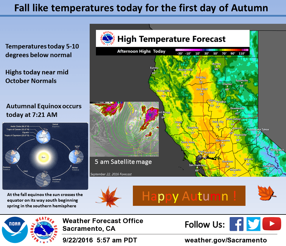
Cool upper low pressure system currently centered near the California/Oregon border and continuing eastward. Upward motion east of the low center is generating some light showers over the southern Cascades at this time. Models dig the low center to the southeast and into the Great Basin today. Disturbances dropping down the back side of the low and wrap around moisture may allow for some scattered showers over the Sierra Cascade range today. Instability is limited so have kept mention of thunderstorms to just the highest elevations. For the rest of the forecast area…expecting still cooler temperatures with highs remaining in the 70s throughout the valley. Northerly flow behind the retreating low will bring breezy north winds across the forecast area over the next few days. High pressure building over the west coast will bring the beginning of a warming trend on Friday with highs warming several degrees. Still more warming on Saturday as the upper ridge amplifies along the west coast. Substance and northerly breezes will bring daytime highs up to a few degrees above normal for late September. Upper ridge axis shifts inland on Sunday for a bit more warming. Daytime maximum temps will reach about 10 degrees above normal reaching into the 90s most valley locations. The autumnal equinox occurs today at 7:21 AM local time.
Extended discussion (Monday through Thursday)
Strong high pressure over the eastern Pacific Ocean will continue to impact interior NorCal with daytime highs 5-12 degrees above normal on Monday. The high gradually weakens through midweek as a trough over the Pacific Ocean approaches the west coast. Temperatures undergo a subtle cooling trend: on Monday, valley highs will be mid to upper 90s cooling to the upper 80s to low 90s by Thursday. Dry weather persists in the extended forecast.