September 25, 2016 – Dry weather with above normal temperatures through Tuesday. Cooling trend begins Wednesday. Breezy north winds today will gradually weaken this evening into Monday.
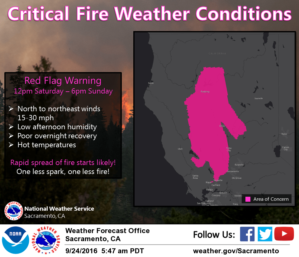
Red Flag Warning until 6 PM PDT this evening for Central Sacramento Valley in Glenn, Colusa, Yuba, Northern Sutter, and Butte County Below 1000 Ft-Eastern Mendocino NF-Eastern Portion of Shasta/Trinity NF-Lake County Portion of Lake-Napa-Sonoma Unit-Northern Sacramento Valley to Southern Tehama County Line Below 1000 Ft-Northern Sierra Foothills from 1000 to 3000 Ft. Includes portions of Shasta-Trinity and Butte Units-Northern Sierra Including Lassen NP and Plumas and Lassen NF/S West of the Sierra Crest (West of Evans Peak-Grizzly Peak-Beckworth Peak)-Southeast Edge Shasta-Trinity NF and Western Portions of Tehama-Glenn Unit-Southern Sacramento Valley in Yolo-Sacramento Far Western Placer, southern Sutter and Solano County Below 1000 Ft.
Discussion
A strong ridge of high pressure over the region will persist through early this week. Temperatures will be warming between 95 to 102 degrees today with the 100 plus temperatures over the north end of the valley. Very warm temperatures will continue through Tuesday with highs between 95 and 100 degrees for the valley.
Locally breezy north winds mainly for the west side of the valley and for some foothill and mountain locations will continue today although the foothill and mountain winds should taper by noon. The winds in the mountains will increase once again this evening with local gusts up to 35 mph into Monday morning.
Temperatures at night should cool off nicely with the exception of the thermal belt areas which could see lows in the lower 70s.
Wednesday will be a transition day as the ridge starts to break down and a trough begins to deepen over the west coast. Temperatures will start to trend cooler.
Extended discussion (Thursday through Sunday)
Upper high pressure shifts east as a series of weather systems push through the PacNW late next week. The tail end of these systems may bring a few showers to the northern mountains. Temperatures will cool back to below average.