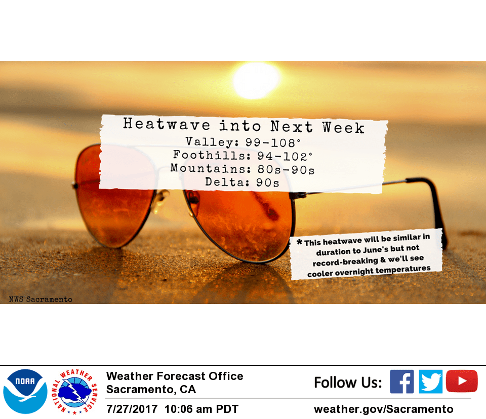
July 28, 2017 – Hot weather will continue into next week. Isolated afternoon or evening thunderstorms near the Sierra crest.
Discussion
Fair skies over the CWA this morning under upper southwest flow between high pressure aloft over the southwest U.S. and weak trough off the north coast. Upper trough forecast to lift to the northeast today. Overall airmass should be fairly similar to Friday so most locations should come in with daytime highs similar as well. Delta breeze is expected to come in a bit stronger however so delta influenced areas may see a bit of cooling today. Most locations will see stable southwest flow this afternoon but southerly flow over the southern most CWA could allow for isolated Sierra crest thunderstorms. Upper ridge over southwest U.S is forecast to retrograde westward over the weekend bringing warming.
Most locations will see a little warming each day. Delta influenced areas will take an extra day to start warming thanks to a continued weak delta breeze.
By Sunday, most locations will see high temperatures up to almost 10 degrees above normal. Still looking at a slight threat of Sierra crest thunderstorms south of the Tahoe area where southerly flow aloft could bring sub tropical moisture northward. Upper ridge centers over the west coast on Monday bringing still more warming. Temperatures climb high enough by Monday to start looking into possible need for heat products going into next week.
Extended discussion (Tuesday through Friday)
Hot weather continues next week as strong high pressure dominates the West. Daytime temperatures expected to be about 10 degrees above average with most of the valley well over the century mark with some record high temperatures possible. There will be enough onshore flow to moderate temperatures in the Delta and southern Sacramento Valley. Increasing chance for mountain thunderstorms and possibly even some elevated convection elsewhere by mid-week as monsoon moisture spreads northward.