Hot and dry conditions gradually give way to moderating temperatures by mid-week.
Discussion
Skies are clear across the region early this morning. IR difference imagery shows stratus spreading through much of the Bay Area, and profiler data indicate the marine layer is slightly above 1k ft in depth. Surface pressure gradients are trending onshore and a strong Delta Breeze is underway with local gusts of 35-45 mph around Travis AFB, and gusts to around 20 mph currently extending as far inland as the Sacramento region. This has brought significant cooling inland to the northern San Joaquin Valley and most of the Sacramento Valley where current temperatures are in the 60s and 70s compared to mainly 80s to lower 90s at this time yesterday.
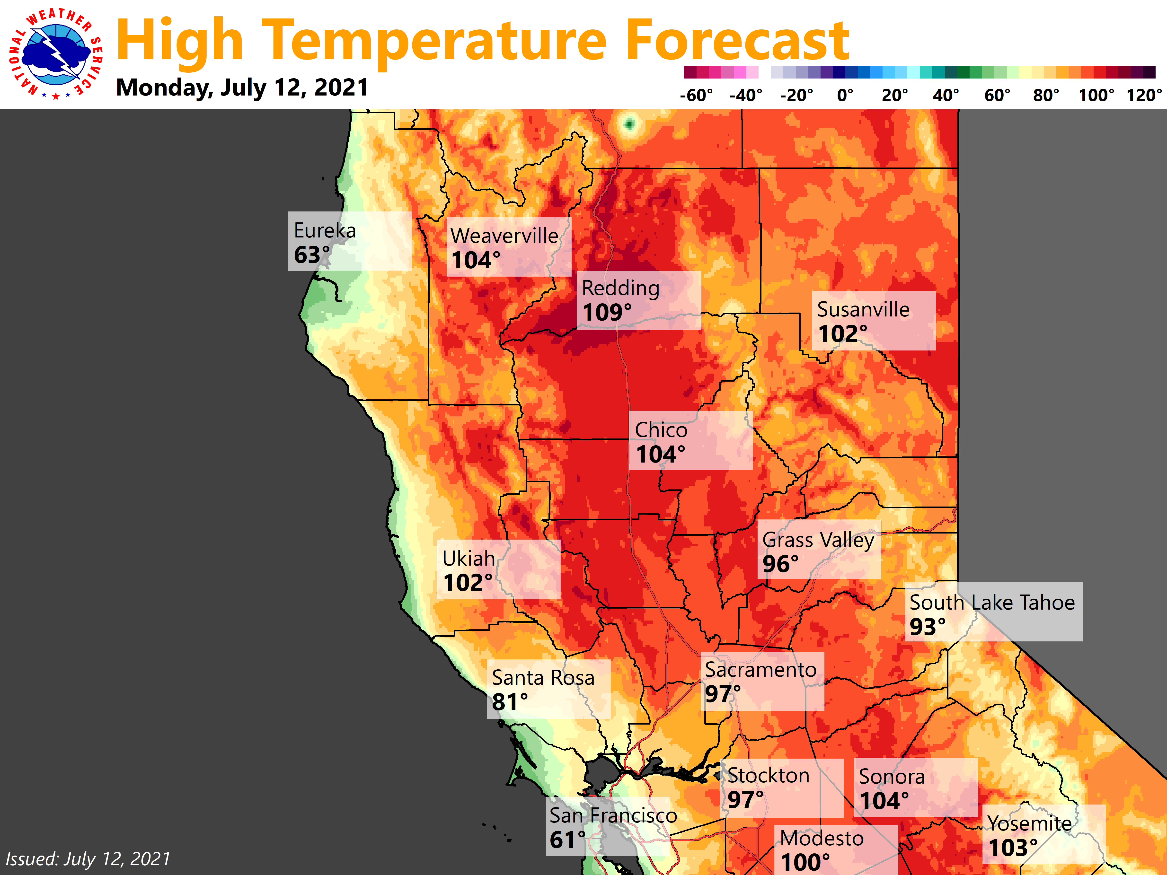
Very hot weather will persist for another day well inland where highs will once again exceed 110 degrees across portions of Shasta County. High to very high heat risk lingers for much of the region and the Excessive Heat Warning will remain in effect into this evening.

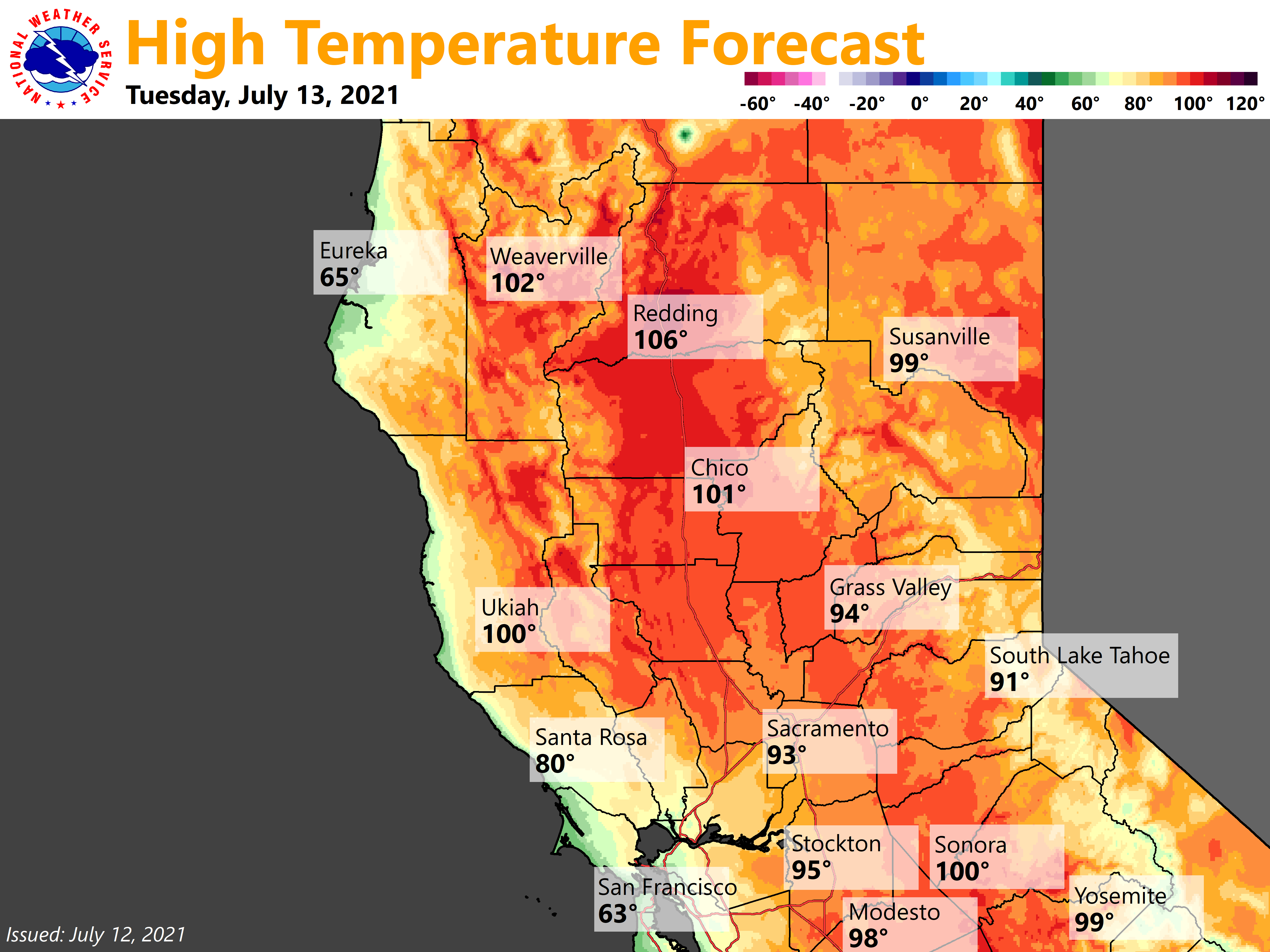
High pressure will gradually ease its grip heading into mid-week. Hot weather will continue across the northern portion of the forecast area, but temperatures will be down a few degrees each day there as onshore flow eventually spreads further inland. By Thursday, enough modified marine influence may make it all the way up the Sacramento Valley to end the current streak of triple digit heat at Redding (today would be 18 consecutive days at or above 100).

A moderate to strong Delta Breeze will keep the southern Sacramento and northern San Joaquin Valleys in the 80s to mid 90s through most of this week.
Shower and thunderstorm activity is expected to remain well east of the area for the foreseeable future. A modest amount of elevated moisture and instability will move up from the south today and spread across the southeastern half of the forecast area and may bring a few mid and high clouds and perhaps some virga.
Extended Discussion (Friday through Monday)
Troughing is expected for the extended period across the west. This will help temperatures cool to near normal for this time of year and we will likely see highs drop below the century mark in the northern Sac Valley for the first time in almost 3 weeks.
This troughing pattern will also bring increased onshore flow and locally gusty afternoon and evening winds will be possible at times, especially for Delta influenced areas and over higher elevations. Moisture and instability will be limited and no shower or thunderstorm chances are expected.