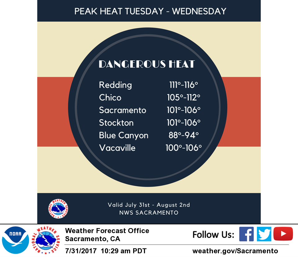
August 1, 2017 – Heatwave this week peaking today and Wednesday. Isolated late-day thunderstorms possible mainly near the Sierra crest.
Discussion
Delta Breeze continues, but it’s influence inland is waning as onshore gradients slacken and the marine layer becomes a little more compressed. Current temperatures are milder across the region compared to 24 hours ago and generally range from the 50s in the mountain valleys to the upper 70s and lower 80s across the mildest portions of the Central Valley.
Today and Wednesday looks to be the peak of this heatwave with hottest readings around 115 expected across the northern Sacramento Valley. Smoke from area wildfires may be enough to shave several degrees off highs from what they otherwise would be.
Records the next several days are listed below:
RECORDS: Today Wednesday Thursday
Redding Airport………113 1993….111 1993….112 1998
Red Bluff Sacramento….111 1993….111 1977….112 1998
Sacramento Exec………106 1993….106 1975….106 1975
Sacramento…………..109 1993….108 1987….107 1998
Stockton…………….109 1980….105 1993….108 1998
Modesto……………..106 2014….104 1980….106 1998
Temperatures begin to trend downward on Thursday as a disturbance approaches from the south and cloud cover increases. While it is expected to cool off a bit, it will still be hot for the remainder of the week with most of the Valley remaining in triple digits.
Moisture spreading northward late this week, along with a more favorable upper flow could lead to late-day convection. There are model differences at this point, but will have to monitor the potential for convection.
Extended discussion (Saturday through Tuesday)
Strong upper ridge centered over Nevada weakens and shifts east through the extended forecast period as upper trough approaches. Above normal temperatures continue into early next week with highs from the upper 90s to around 106 in the Central Valley and 80s to 90s in the foothills and mountains. Monsoonal flow will keep a threat of afternoon thunderstorms over the mountains.