Heat Advisory from noon today to 7 pm Sunday. High to locally very high heat risk is expected for much of the region this weekend. Mostly dry weather forecast except for a few mountain thunderstorms through the weekend. Not as hot early next week.

Discussion
Partly to mostly cloudy skies cover the region early this morning from a combination of wildfire smoke and some mid and high clouds from the remnants of former TS Kevin, though most of its remains are moving north off the coast. Onshore flow has weakened considerably since early Friday, and current temperatures are very mild compared to 24 hours ago ranging from the upper 60s to lower 80s through the Central Valley.
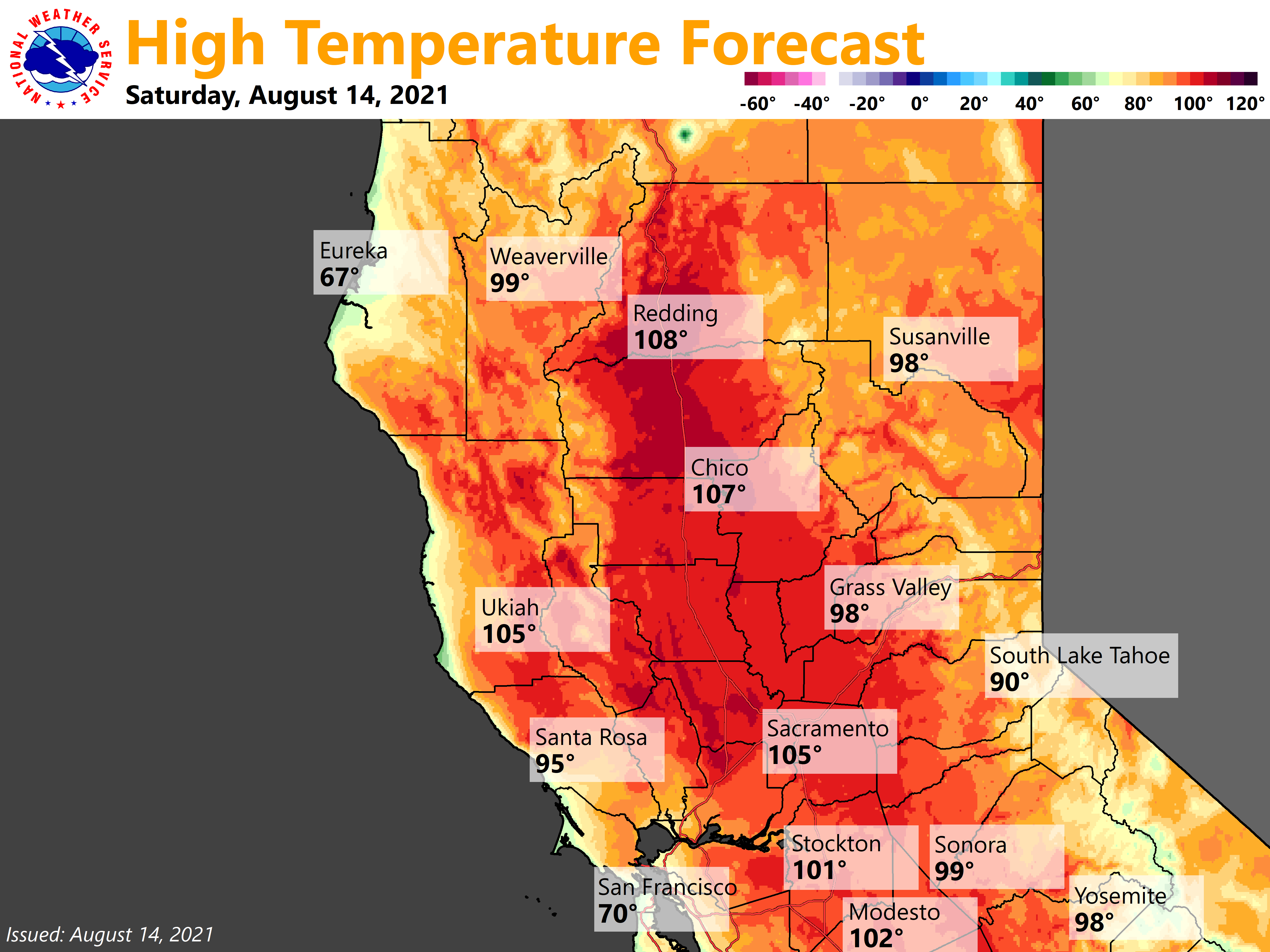
High pressure will strengthen over the area this weekend resulting in widespread high, with locally very high, heat risk, especially for the Central Valley and adjacent foothills. Wildfire smoke may help to keep temperatures down locally, but lower elevation areas that see sufficient insolation will see highs above 105 with potential for 110 or above across the northern Sacramento Valley. Overnight lows will remain very mild the next several nights as any Delta influence will be minimal. Heat Advisory remains in effect.
Late day storms will likely be a little more isolated today as developing updrafts will have to overcome the building ridge. Any storms that do develop will have the potential for gusty outflow winds and some lightning with little rain. A few late day storms will be possible again on Sunday.
Temperatures will cool off a bit on Monday as a trough approaches, and then stronger cooling is expected Tuesday as temperatures return to close to normal. Locally breezy winds will be possible this trough passes Monday into Tuesday. The strongest winds will be seen in favored terrain, over ridges, and in the Delta region.
Extended Discussion (Wednesday through Saturday)
Most ensemble clusters advertise a weak trough lingering over NorCal later next week as strong ridging develops upstream over the eastern Pacific. Airmass is likely to remain too dry/stable for diurnal deep convection over the mountains. Temperatures expected to be a little above average, though wildfire smoke will undoubtedly continue to impact them from day-to-day.