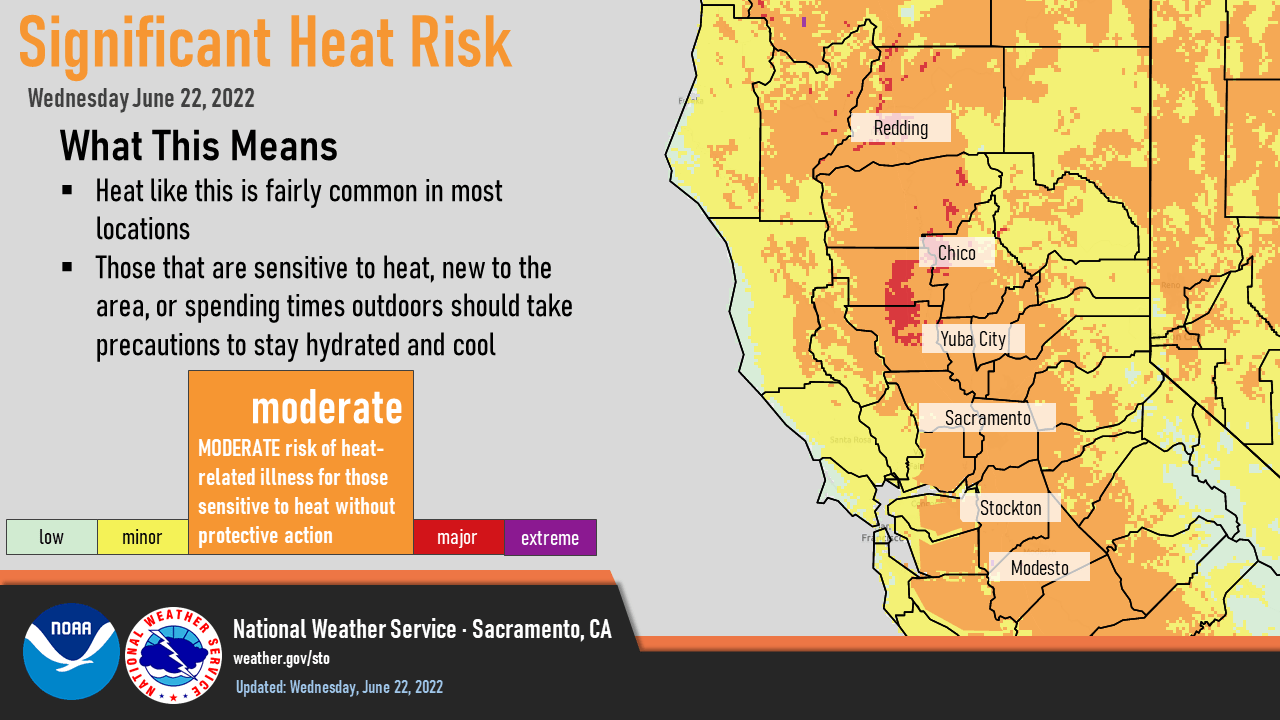
Triple digit heat continues across the Central Valley through the weekend. Monsoon moisture will lead to a few showers and thunderstorms over the northern Sierra late this week. Heat Advisory until 10 PM this evening. Moderate Risk for heat-related illnesses for pets, livestock, and those who are sensitive to heat, especially those without effective cooling and/or adequate hydration.
Discussion
Skies are clear across NorCal early this morning. Offshore surface pressure gradient remains, but has eased off the highs from early Tuesday. Local easterly gusts of 20-30 mph persist across the breezier spots in the northern Sierra, with lighter north to east winds across most of the remainder of the region. Current temperatures are very mild with 70s to lower 80s across most of the Central Valley except for the immediate Delta region which is in the mid 60s.

Widespread moderate, with local high, heat risk continues today though temperatures will ease off a bit from Tuesday’s highs across the southern half of the Sacramento Valley southward into the northern San Joaquin Valley as onshore flow returns and clouds spread northward from central California. Water vapor imagery shows the low is off the coast to the west southwest of Vandenberg.
Mid and upper level moisture and instability is continuing to work its way northward and a few thunderstorms are developing over central California. Some of this activity will work its way northward into the Motherlode and northern Sierra later this morning and into the afternoon as the low moves closer to the coast. The low is forecast to move across central California tonight, and areas to the south of Sacramento may see some sprinkles or an isolated shower.

Thunderstorm chances may continue overnight for the southern Motherlode and Sierra south of Tahoe closer to the low center as it moves east. Afternoon thunderstorms will be possible over the higher elevations of the northern Sierra The low shifts east by Friday day and enough moisture remains for mainly late-day thunderstorms along the Sierra crest south of Tahoe into the weekend. Temperatures will remain above average, but not as hot as currently.

Extended Discussion (Sunday through Wednesday)
Cluster and ensemble analysis continues broad ridging over the Western States through the extended. This will result in dry weather with Valley highs holding from the mid 90’s to near 100 into the middle of next week. Occasional afternoon and evening onshore breezes may help moderate temperatures in the vicinity of the Delta.