Mostly dry weather with warm temperatures today. Chances for mountain thunderstorms each day today through this week with more widespread thunderstorm chances Monday and Tuesday. Cooler temperatures early this week before warming again midweek.

Discussion
High pressure centered over the Desert Southwest remains stretched over CA today. Models do show a tightening of the pressure gradient over the Delta region today which corresponds with the increase in onshore flow and the Delta breeze today. Therefore, temperatures will begin cooling a few degrees from yesterday for areas that were not impacted by smoke.
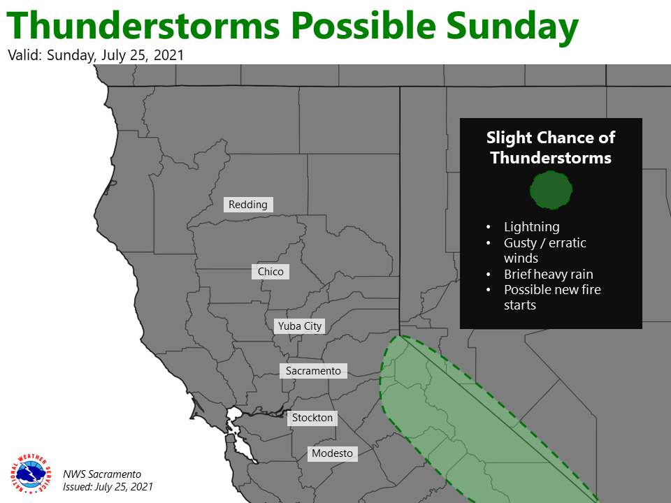
Smoke forecast in the northern portion of the CWA remains difficult. Light winds early in the day could allow smoke to move into the Valley once again, but with the onshore flow slightly stronger than yesterday, the smoke theoretically should not be quite as thick and should move out faster than yesterday. Monsoon moisture begins pushing into northern CA today, bringing a chance of thunderstorms this afternoon and evening to the Sierra south of Highway 50.
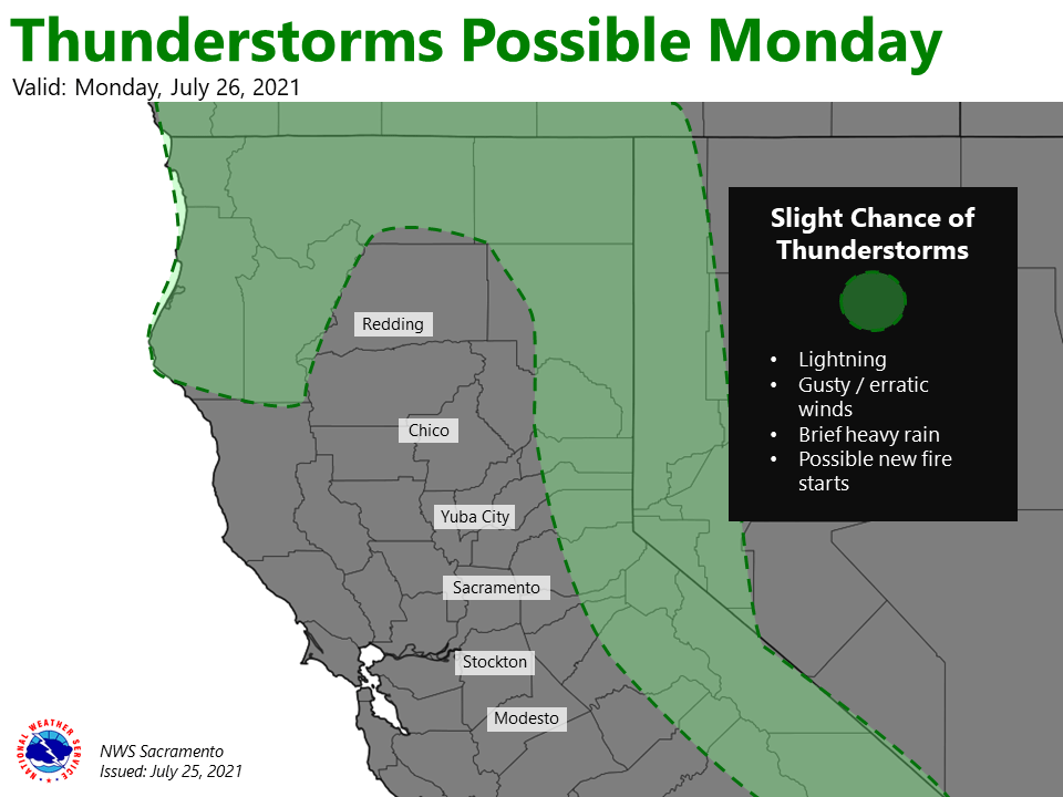
Ensembles indicate a weak trough will set up over the Eastern Pacific beginning Monday, which pushes the western edge of the monsoon high east to set up over CA. Better chances for thunderstorms are Monday and Tuesday as a shortwave moves through CA, bringing the main push of monsoon moisture through the area. Uncertainty still remains in the extent of thunderstorm coverage, but best chances remain over the mountains and foothills.
Timing wise, convection potential begins Monday afternoon over the Sierra and possibly to the west of our forecast area. Convective potential spreads north into the Coastal Range and Shasta County overnight into Tuesday morning.
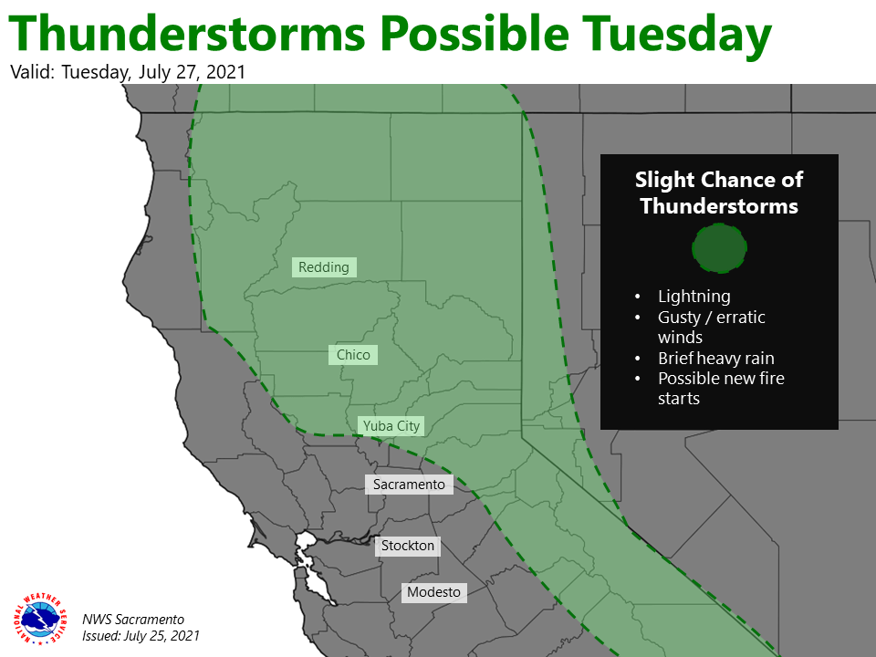
There is increasing chance in showers and thunderstorms in the northern Sacramento Valley Tuesday. Will need to keep an eye on elevated instability for chances further south, but right now it seems meager. PWAT values remain high, so thunderstorms would produce rain, especially over the higher elevations.
Some heavier rain showers are possible along with gusty wind and lightning. The wave is slated to move out by Tuesday night with another weaker wave moving along the flow Wednesday. Thunderstorm chances Wednesday are limited to the Sierra.
Temperatures are forecast to cool to near or slightly below normal by Monday. Significant cooling is forecast on Tuesday in the northern Sacramento Valley due to cloud cover.
Valley temperatures Tuesday will range from the upper 80s in the north to mid 90s in the south. Temperatures will rebound Wednesday as onshore flow cuts off and cloud cover dissipates.
Extended Discussion (Thursday through Sunday)
NorCal will remain on the periphery of the large high centered over the central US during the latter half of the week.
Hot and dry conditions expected except for daily diurnal thunderstorms possible over the northern Sierra, mainly to the south of Interstate 80. Temperatures will likely be a little above average.